Area Overview for CO5 7ES
Photos of CO5 7ES
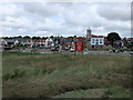
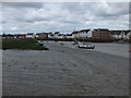
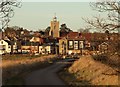
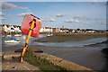
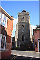
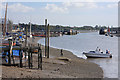
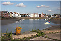

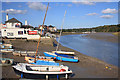
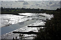
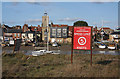
100 photos from this area
Area Information
Key information about the CO5 7ES including its size, population, and administrative classification.
- Area Type
- Postcode
- Area Size
- 2.2 hectares
- Population
- 2138
- Population Density
- 3861 people/km²
House Prices in CO5 7ES
14
Properties
£416,667
Average Sold Price
£250,000
Lowest Price
£635,000
Highest Price
Showing 14 properties
| Address | Type | Beds | Baths | Last Sale Price | Last Sale Date | |
|---|---|---|---|---|---|---|
| Old Ship House, 22 High Street, Rowhedge, CO5 7ES | Semi-detached | 5 | 3 | £635,000 | Nov 2018 | |
| 25 High Street, Rowhedge, CO5 7ES | house | 4 | - | £250,000 | May 2013 | |
| 21 High Street, Rowhedge, CO5 7ES | house | - | - | £365,000 | Dec 2010 | |
| Curlew Cottage, 27 High Street, Rowhedge, CO5 7ES | Terraced | 3 | 1 | - | - | |
| 20A High Street, Rowhedge, CO5 7ES | Flat | 4 | - | - | - | |
| Rowhedge Heritage Trust, Lion Quay, High Street, Rowhedge, CO5 7ES | Office | - | - | - | - | |
| Flat Above, 29 High Street, Rowhedge, CO5 7ES | Flat | - | - | - | - | |
| 26 High Street, Rowhedge, CO5 7ES | Terraced | - | - | - | - | |
| 20 High Street, Rowhedge, CO5 7ES | Detached | - | - | - | - | |
| 24 High Street, Rowhedge, CO5 7ES | Terraced | - | - | - | - |
Page 1 of 2
Energy Efficiency in CO5 7ES
Amenities
Schools
| Rank | School | Type | Entry gender | Ages |
|---|
Explore more schools in this area
Go to Schools tabDemographics
Household Size
Two person
most common
Accommodation Type
Houses
most common
Tenure
75
majority
Ethnic Group
White
most common
Religion
N/A
most common
Household Composition
N/A
most common
Age
47
median
Adults (30-64 years)
most common
Household Deprivation
N/A
with no deprivation
NS-SEC
40
in Lower managerial occupations
Explore more demographic insights in this area
Go to Demographics tabPlanning
Planning Constraints
- Flood RiskPremium
- Ramsar Wetland SitesPremium
- Area of Outstanding Natural BeautyPremium
- Protected Nature ReservePremium
- Protected WoodlandPremium