Area Overview for CO5 7DG
Photos of CO5 7DG
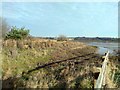
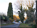
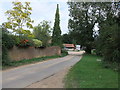
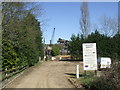
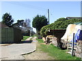
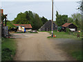
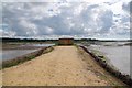
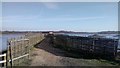
17 photos from this area
Area Information
Key information about the CO5 7DG including its size, population, and administrative classification.
- Area Type
- Postcode
- Area Size
- 85.2 hectares
- Population
- 1471
- Population Density
- 46 people/km²
House Prices in CO5 7DG
18
Properties
£217,541
Average Sold Price
£46,000
Lowest Price
£875,000
Highest Price
Showing 18 properties
| Address | Type | Beds | Baths | Last Sale Price | Last Sale Date | |
|---|---|---|---|---|---|---|
| 19 Brook Hall Road, Fingringhoe, CO5 7DG | Bungalow | - | - | £432,000 | Jan 2021 | |
| 18 Brook Hall Road, Fingringhoe, CO5 7DG | house | - | - | £167,500 | Apr 2013 | |
| Brook Cottage, 24 Brook Hall Road, Fingringhoe, CO5 7DG | Bungalow | 4 | 2 | £220,000 | Feb 2012 | |
| 22 Brook Hall Road, Fingringhoe, CO5 7DG | Terraced | - | - | £168,000 | Jul 2008 | |
| 20 Brook Hall Road, Fingringhoe, CO5 7DG | Terraced | - | - | £161,000 | May 2008 | |
| Lower Brickhouse Farm, Brook Hall Road, Fingringhoe, CO5 7DG | Detached | 7 | 4 | £875,000 | May 2008 | |
| 33 Brook Hall Road, Fingringhoe, CO5 7DG | house | - | - | £190,000 | Feb 2004 | |
| 31 Brook Hall Road, Fingringhoe, CO5 7DG | Detached | - | - | £107,000 | Sep 2000 | |
| 23 Brook Hall Road, Fingringhoe, CO5 7DG | Detached | - | - | £89,000 | Sep 1999 | |
| 25 Brook Hall Road, Fingringhoe, CO5 7DG | house | - | - | £79,995 | Jan 1998 |
Page 1 of 2
Energy Efficiency in CO5 7DG
Amenities
Schools
| Rank | School | Type | Entry gender | Ages |
|---|
Explore more schools in this area
Go to Schools tabDemographics
Household Size
Two person
most common
Accommodation Type
Houses
most common
Tenure
86
majority
Ethnic Group
White
most common
Religion
N/A
most common
Household Composition
N/A
most common
Age
47
median
Adults (30-64 years)
most common
Household Deprivation
N/A
with no deprivation
NS-SEC
39
in Lower managerial occupations
Explore more demographic insights in this area
Go to Demographics tabPlanning
Planning Constraints
- Flood RiskPremium
- Area of Outstanding Natural BeautyPremium
- Protected WoodlandPremium