Area Overview for CO5 0RH
Photos of CO5 0RH
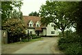

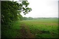
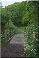
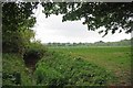
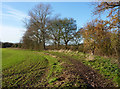
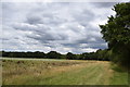
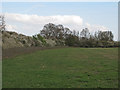

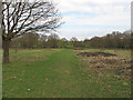

21 photos from this area
Area Information
Key information about the CO5 0RH including its size, population, and administrative classification.
- Area Type
- Postcode
- Area Size
- 37.6 hectares
- Population
- 1292
- Population Density
- 80 people/km²
House Prices in CO5 0RH
41
Properties
£304,471
Average Sold Price
£34,333
Lowest Price
£700,000
Highest Price
Showing 41 properties
| Address | Type | Beds | Baths | Last Sale Price | Last Sale Date | |
|---|---|---|---|---|---|---|
| Highfield, 44 Brook Road, Tolleshunt Knights, CO5 0RH | Detached | 4 | - | £645,000 | Sep 2025 | |
| 91 Brook Road, Tolleshunt Knights, CO5 0RH | Semi-detached | 3 | 1 | £270,000 | Feb 2024 | |
| Hill Cottage, 65 Brook Road, Tolleshunt Knights, CO5 0RH | house | 4 | 3 | £700,000 | Aug 2022 | |
| Bovisand, 93 Brook Road, Tolleshunt Knights, CO5 0RH | Semi-detached | 2 | 1 | £330,000 | Jul 2022 | |
| Little Oak, 63 Brook Road, Tolleshunt Knights, CO5 0RH | Bungalow | - | - | £340,000 | Jan 2022 | |
| 73 Brook Road, Tolleshunt Knights, CO5 0RH | Bungalow | - | - | £375,000 | Mar 2020 | |
| Barleymead, 36B Brook Road, Tolleshunt Knights, CO5 0RH | Bungalow | 3 | - | £415,000 | Aug 2019 | |
| Cherry Trees, 62A Brook Road, Tolleshunt Knights, CO5 0RH | Detached | 4 | - | £435,000 | Mar 2017 | |
| 66 Brook Road, Tolleshunt Knights, CO5 0RH | house | - | - | £375,000 | Jan 2017 | |
| Chelsea House, 67 Brook Road, Tolleshunt Knights, CO5 0RH | house | - | - | £405,000 | Feb 2016 |
Page 1 of 5
Energy Efficiency in CO5 0RH
Amenities
Schools
| Rank | School | Type | Entry gender | Ages |
|---|
Explore more schools in this area
Go to Schools tabDemographics
Household Size
Two person
most common
Accommodation Type
Houses
most common
Tenure
86
majority
Ethnic Group
White
most common
Religion
N/A
most common
Household Composition
N/A
most common
Age
47
median
Adults (30-64 years)
most common
Household Deprivation
N/A
with no deprivation
NS-SEC
40
in Lower managerial occupations
Explore more demographic insights in this area
Go to Demographics tabPlanning
Planning Constraints
- Flood RiskPremium
- Ramsar Wetland SitesPremium
- Area of Outstanding Natural BeautyPremium
- Protected Nature ReservePremium
- Protected WoodlandPremium