Area Overview for CO5 0PU
Photos of CO5 0PU
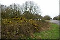
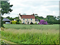
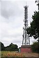
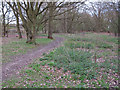
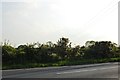
6 photos from this area
Area Information
Key information about the CO5 0PU including its size, population, and administrative classification.
- Area Type
- Postcode
- Area Size
- 8.2 hectares
- Population
- 1483
- Population Density
- 329 people/km²
House Prices in CO5 0PU
14
Properties
£429,600
Average Sold Price
£80,000
Lowest Price
£1,000,000
Highest Price
Showing 14 properties
| Address | Type | Beds | Baths | Last Sale Price | Last Sale Date | |
|---|---|---|---|---|---|---|
| Widanbrook, 220A Maldon Road, Tiptree, CO5 0PU | Detached | 4 | 2 | £446,000 | Jan 2021 | |
| 208 Maldon Road, Tiptree, CO5 0PU | Detached | 4 | 1 | £630,000 | Oct 2020 | |
| 210 Maldon Road, Tiptree, CO5 0PU | Bungalow | 5 | 3 | £560,000 | Feb 2020 | |
| The Hatchery, 234 Maldon Road, Tiptree, CO5 0PU | Bungalow | - | - | £230,000 | Jun 2018 | |
| Holly Tree Farm Barn, Maldon Road, Tiptree, CO5 0PU | Semi-detached | 4 | 3 | £1,000,000 | Jul 2016 | |
| Holly Tree Farm, 232 Maldon Road, Tiptree, CO5 0PU | Farm | 5 | - | £715,000 | Jan 2016 | |
| 216 Maldon Road, Tiptree, CO5 0PU | Bungalow | 2 | - | £205,000 | Feb 2013 | |
| 218 Maldon Road, Tiptree, CO5 0PU | Detached | - | - | £240,000 | Jul 2001 | |
| 222 Maldon Road, Tiptree, CO5 0PU | Detached | - | - | £190,000 | Sep 1999 | |
| 220 Maldon Road, Tiptree, CO5 0PU | Bungalow | - | - | £80,000 | Nov 1995 |
Page 1 of 2
Energy Efficiency in CO5 0PU
Amenities
Schools
| Rank | School | Type | Entry gender | Ages |
|---|
Explore more schools in this area
Go to Schools tabDemographics
Household Size
Two person
most common
Accommodation Type
Houses
most common
Tenure
81
majority
Ethnic Group
White
most common
Religion
N/A
most common
Household Composition
N/A
most common
Age
47
median
Adults (30-64 years)
most common
Household Deprivation
N/A
with no deprivation
NS-SEC
35
in Lower managerial occupations
Explore more demographic insights in this area
Go to Demographics tabPlanning
Planning Constraints
- Flood RiskPremium
- Ramsar Wetland SitesPremium
- Area of Outstanding Natural BeautyPremium
- Protected Nature ReservePremium
- Protected WoodlandPremium