Area Overview for CO5 0NF
Photos of CO5 0NF
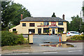

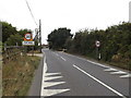
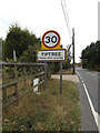
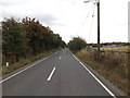
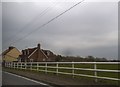

20 photos from this area
Area Information
Key information about the CO5 0NF including its size, population, and administrative classification.
- Area Type
- Postcode
- Area Size
- 3.5 hectares
- Population
- 1518
- Population Density
- 2038 people/km²
House Prices in CO5 0NF
28
Properties
£197,291
Average Sold Price
£48,000
Lowest Price
£395,000
Highest Price
Showing 28 properties
| Address | Type | Beds | Baths | Last Sale Price | Last Sale Date | |
|---|---|---|---|---|---|---|
| 31 Oak Road, Tiptree, CO5 0NF | Terraced | 3 | 1 | £305,000 | Jun 2025 | |
| 21 Oak Road, Tiptree, CO5 0NF | Maisonette | 2 | 1 | £161,500 | Dec 2024 | |
| 25 Oak Road, Tiptree, CO5 0NF | Maisonette | 2 | 1 | £182,000 | Oct 2024 | |
| 18 Oak Road, Tiptree, CO5 0NF | Semi-detached | 3 | 1 | £395,000 | Jun 2024 | |
| 27 Oak Road, Tiptree, CO5 0NF | house | - | - | £255,000 | Jan 2021 | |
| 24 Oak Road, Tiptree, CO5 0NF | Detached | 4 | 1 | £345,000 | Jun 2020 | |
| 17 Oak Road, Tiptree, CO5 0NF | Semi-detached | 3 | 1 | £260,000 | Mar 2020 | |
| 32 Oak Road, Tiptree, CO5 0NF | Detached | 3 | 2 | £277,500 | Jun 2015 | |
| 22 Oak Road, Tiptree, CO5 0NF | house | - | - | £233,500 | Jul 2010 | |
| 14 Oak Road, Tiptree, CO5 0NF | Semi-detached | - | - | £213,750 | Apr 2010 |
Page 1 of 3
Energy Efficiency in CO5 0NF
Amenities
Schools
| Rank | School | Type | Entry gender | Ages |
|---|
Explore more schools in this area
Go to Schools tabDemographics
Household Size
Two person
most common
Accommodation Type
Houses
most common
Tenure
64
majority
Ethnic Group
White
most common
Religion
N/A
most common
Household Composition
N/A
most common
Age
47
median
Adults (30-64 years)
most common
Household Deprivation
N/A
with no deprivation
NS-SEC
24
in Lower managerial occupations
Explore more demographic insights in this area
Go to Demographics tabPlanning
Planning Constraints
- Flood RiskPremium
- Ramsar Wetland SitesPremium
- Area of Outstanding Natural BeautyPremium
- Protected Nature ReservePremium
- Protected WoodlandPremium