Area Overview for CO5 0HS
Photos of CO5 0HS

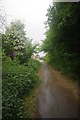
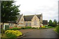
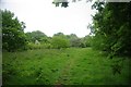
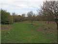
10 photos from this area
Area Information
Key information about the CO5 0HS including its size, population, and administrative classification.
- Area Type
- Postcode
- Area Size
- 3.1 hectares
- Population
- 1884
- Population Density
- 1172 people/km²
House Prices in CO5 0HS
42
Properties
£291,357
Average Sold Price
£76,000
Lowest Price
£625,000
Highest Price
Showing 42 properties
| Address | Type | Beds | Baths | Last Sale Price | Last Sale Date | |
|---|---|---|---|---|---|---|
| 4 Newbridge Road, Tiptree, CO5 0HS | Bungalow | 2 | 1 | £390,000 | Sep 2025 | |
| 37 Newbridge Road, Tiptree, CO5 0HS | Bungalow | 4 | 2 | £530,000 | Mar 2025 | |
| 28 Newbridge Road, Tiptree, CO5 0HS | house | - | - | £316,800 | Nov 2024 | |
| 2 Newbridge Road, Tiptree, CO5 0HS | Bungalow | 3 | 2 | £537,500 | Dec 2023 | |
| 35A Newbridge Road, Tiptree, CO5 0HS | house | - | - | £525,000 | Nov 2021 | |
| Woodside, 12 Newbridge Road, Tiptree, CO5 0HS | Bungalow | 4 | - | £625,000 | Mar 2021 | |
| 19 Newbridge Road, Tiptree, CO5 0HS | Detached | 4 | 1 | £462,000 | Feb 2020 | |
| 21 Newbridge Road, Tiptree, CO5 0HS | Detached | 4 | 1 | £380,000 | Mar 2017 | |
| 23 Newbridge Road, Tiptree, CO5 0HS | Semi-detached | 3 | 1 | £249,995 | Nov 2015 | |
| 24 Newbridge Road, Tiptree, CO5 0HS | Semi-detached | - | - | £287,000 | Feb 2015 |
Page 1 of 5
Energy Efficiency in CO5 0HS
Amenities
Schools
| Rank | School | Type | Entry gender | Ages |
|---|
Explore more schools in this area
Go to Schools tabDemographics
Household Size
Two person
most common
Accommodation Type
Houses
most common
Tenure
77
majority
Ethnic Group
White
most common
Religion
N/A
most common
Household Composition
N/A
most common
Age
47
median
Adults (30-64 years)
most common
Household Deprivation
N/A
with no deprivation
NS-SEC
31
in Lower managerial occupations
Explore more demographic insights in this area
Go to Demographics tabPlanning
Planning Constraints
- Flood RiskPremium
- Ramsar Wetland SitesPremium
- Area of Outstanding Natural BeautyPremium
- Protected Nature ReservePremium
- Protected WoodlandPremium