Area Overview for CO4 9PU
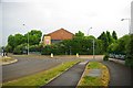
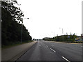
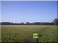
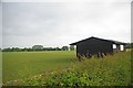
Photos of CO4 9PU


Area Information
CO4 9PU is a small, densely populated postcode area in Colchester, England, covering just 2.5 hectares and home to 1,544 residents. Its compact size means it is a tightly knit residential cluster, typical of suburban Colchester’s layout. The area is part of the Highwoods ward, a suburban ward north of the city centre, known for its mix of housing developments and proximity to green spaces like High Woods Country Park. With a population density of 62,982 people per square kilometre, the area is highly residential, though its small footprint suggests a focus on established housing rather than new builds. Living here offers proximity to Colchester’s main railway station and key retail hubs, while the surrounding suburbs provide a balance between urban convenience and suburban tranquillity. The area’s character is defined by its proximity to both the city’s infrastructure and natural amenities, making it appealing to those seeking a blend of accessibility and green space. However, its size means it is more of a micro-locale within Colchester, with daily life revolving around nearby amenities and transport links.
- Area Type
- Postcode
- Area Size
- 2.5 hectares
- Population
- 1544
- Population Density
- 4206 people/km²
The property market in CO4 9PU is dominated by owner-occupied homes, with 52% of residents owning their properties. This suggests a stable, low-turnover market, typical of established suburban areas. The accommodation type is primarily houses, which is unusual for a small postcode area but may indicate a focus on family homes or larger residences. Given the area’s compact size, the housing stock is likely limited to existing developments rather than new builds, which could affect availability for buyers. The high proportion of homeownership suggests that rental properties are less common, potentially making the market less accessible to those seeking to rent. For buyers, this means competition may be fierce, particularly for properties that meet the demand for family-friendly housing. The proximity to Colchester’s amenities and transport links adds value, but the small area size means buyers should consider nearby suburbs for broader options.
House Prices in CO4 9PU
Showing 1 properties
| Address | Type | Beds | Baths | Last Sale Price | Last Sale Date | |
|---|---|---|---|---|---|---|
| Caretakers Bungalow, Gilberd School, Brinkley Lane, Colchester, CO4 9PU | Detached | - | - | - | - |
Energy Efficiency in CO4 9PU
Residents of CO4 9PU have access to a range of amenities within practical reach, including five retail venues such as Tesco Colchester, M&S Colchester Eastwood BP, and Sainsburys Colchester. These shops provide everyday convenience, from groceries to clothing. The area’s proximity to Colchester’s railway stations ensures easy access to public transport, while High Woods Country Park offers a significant green space for leisure activities. The park’s 150-hectare size provides opportunities for walking, cycling, and outdoor recreation, though it is bordered by busy roads. The presence of multiple railway stations and retail options suggests a lifestyle that blends suburban tranquillity with urban connectivity. However, the small area size means that more specialised amenities, such as cinemas or large supermarkets, may require a trip to Colchester’s town centre. The mix of green space and retail access creates a balanced environment for daily life.
Amenities
Schools
The nearest schools to CO4 9PU include The Gilberd School, which operates both as a primary school and an academy with an Ofsted rating of outstanding. This dual role suggests it serves a wide age range, potentially catering to local families from early education through to secondary schooling. The Trinity School, another academy, adds to the area’s educational options. The presence of two academies with high ratings indicates a strong focus on quality education, which is a key consideration for families. The outstanding rating at The Gilberd School, in particular, signals a school that meets or exceeds national standards in teaching and outcomes. However, the data does not specify the exact locations of these schools relative to CO4 9PU, so potential buyers should verify proximity. The mix of school types provides flexibility, though the small area size may mean that students rely on transport links to access these institutions.
| Rank | School | Type | Entry gender | Ages |
|---|
Explore more schools in this area
Go to Schools tabDemographics
The population of CO4 9PU has a median age of 47, with the majority of residents aged between 30 and 64. This suggests a community of largely middle-aged adults, likely including families and professionals. Home ownership is strong, with 52% of residents owning their homes, indicating a stable housing market. The predominant accommodation type is houses, reflecting a suburban rather than high-density residential profile. The area’s demographic is largely homogenous, with the White ethnic group forming the majority. This aligns with broader trends in Colchester, though specific data on diversity is not provided. The age profile suggests a mature population, which may influence local services and amenities. The high proportion of homeownership and the presence of family-focused housing types imply a community prioritising long-term stability. However, the lack of data on deprivation or income levels means the full picture of quality of life remains partially obscured.
Household Size
Accommodation Type
Tenure
Ethnic Group
Religion
Household Composition
Age
Household Deprivation
NS-SEC
Explore more demographic insights in this area
Go to Demographics tabPlanning
Planning Constraints
- Flood RiskPremium
- Ramsar Wetland SitesPremium
- Area of Outstanding Natural BeautyPremium
- Protected Nature ReservePremium
- Protected WoodlandPremium