Area Overview for CO4 9EW
Photos of CO4 9EW
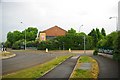

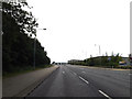
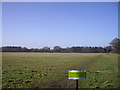
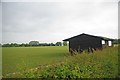
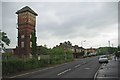
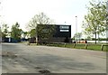
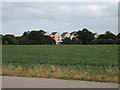
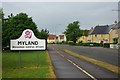
10 photos from this area
Area Information
Key information about the CO4 9EW including its size, population, and administrative classification.
- Area Type
- Postcode
- Area Size
- 1.2 hectares
- Population
- 2074
- Population Density
- 1427 people/km²
House Prices in CO4 9EW
18
Properties
£412,103
Average Sold Price
£309,950
Lowest Price
£625,000
Highest Price
Showing 18 properties
| Address | Type | Beds | Baths | Last Sale Price | Last Sale Date | |
|---|---|---|---|---|---|---|
| 152 Gavin Way, Colchester, CO4 9EW | Detached | 4 | 3 | £625,000 | May 2023 | |
| 138 Gavin Way, Colchester, CO4 9EW | Detached | 4 | 2 | £599,950 | Jan 2023 | |
| 144 Gavin Way, Colchester, CO4 9EW | Detached | 4 | - | £476,000 | Feb 2021 | |
| 146 Gavin Way, Colchester, CO4 9EW | Detached | 4 | 1 | £485,000 | Jul 2019 | |
| 140 Gavin Way, Colchester, CO4 9EW | Detached | 5 | 2 | £475,000 | Apr 2019 | |
| 142 Gavin Way, Colchester, CO4 9EW | house | 5 | - | £395,000 | Aug 2012 | |
| 164 Gavin Way, Colchester, CO4 9EW | house | 5 | - | £310,000 | May 2012 | |
| 162 Gavin Way, Colchester, CO4 9EW | house | 5 | - | £309,950 | Jun 2007 | |
| 166 Gavin Way, Colchester, CO4 9EW | Detached | - | - | £349,950 | Nov 2005 | |
| 156 Gavin Way, Colchester, CO4 9EW | Detached | - | - | £345,000 | Sep 2004 |
Page 1 of 2
Energy Efficiency in CO4 9EW
Amenities
Schools
| Rank | School | Type | Entry gender | Ages |
|---|
Explore more schools in this area
Go to Schools tabDemographics
Household Size
Family (3-5 people)
most common
Accommodation Type
Houses
most common
Tenure
55
majority
Ethnic Group
White
most common
Religion
N/A
most common
Household Composition
N/A
most common
Age
47
median
Adults (30-64 years)
most common
Household Deprivation
N/A
with no deprivation
NS-SEC
37
in Lower managerial occupations
Explore more demographic insights in this area
Go to Demographics tabPlanning
Planning Constraints
- Flood RiskPremium
- Ramsar Wetland SitesPremium
- Area of Outstanding Natural BeautyPremium
- Protected Nature ReservePremium
- Protected WoodlandPremium