Area Overview for CO4 9ED
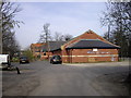
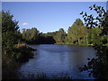
Photos of CO4 9ED


Area Information
Living in CO4 9ED, a small residential cluster in Colchester, offers a blend of suburban tranquillity and urban accessibility. Situated north of the town centre, this area is part of the Highwoods ward, known for its housing developments and proximity to High Woods Country Park. With a population of 1,447 spread across 4.2 hectares, the density is exceptionally high at 34,085 people per square kilometre, reflecting a compact, community-focused environment. The area’s character is defined by its suburban layout, with homes set within a network of roads that connect to Colchester’s broader infrastructure. Nearby, the High Woods Country Park provides a significant green space, offering residents a retreat from the built environment. The proximity to Colchester Railway Station, Hythe Railway Station, and Colchester Town Railway Station ensures easy access to regional transport, while retail options like Tesco Colchester and M&S Colchester Eastwood BP cater to daily needs. This area is ideal for those seeking a balance between suburban living and city connectivity, with a strong emphasis on local amenities and green spaces.
- Area Type
- Postcode
- Area Size
- 4.2 hectares
- Population
- 1447
- Population Density
- 1738 people/km²
The property market in CO4 9ED is characterised by a high rate of home ownership (77%), with houses forming the predominant type of accommodation. This suggests a market skewed towards owner-occupied homes rather than rental properties, indicating a community of long-term residents. Given the area’s small size (4.2 hectares) and high population density, the housing stock is likely limited, with properties concentrated in a compact cluster. Buyers should consider the proximity to amenities such as High Woods Country Park and Colchester’s rail network, which enhance the area’s appeal. However, the limited size of the area means that property availability may be constrained, and potential buyers should explore nearby suburbs for additional options. The predominance of houses over flats or apartments also suggests a focus on family-friendly, spacious living.
House Prices in CO4 9ED
Showing 3 properties
| Address | Type | Beds | Baths | Last Sale Price | Last Sale Date | |
|---|---|---|---|---|---|---|
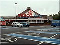
| Tesco, Tesco Garage, Tesco Supermarket, Highwoods Square, Colchester, CO4 9ED | Retail | - | - | - | - | |
| Tesco Pharmacy, Tesco Supermarket, Highwoods Square, Colchester, CO4 9ED | shop | - | - | - | - | |
| Tesco, Click And Collect Point, Tesco Supermarket, Highwoods Square, Colchester, CO4 9ED | shop | - | - | - | - |
Energy Efficiency in CO4 9ED
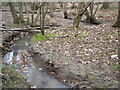
Residents of CO4 9ED enjoy a lifestyle enriched by nearby amenities and natural spaces. The area’s retail offerings include major stores like Tesco Colchester and M&S Colchester Eastwood BP, providing convenience for daily shopping needs. The proximity to Colchester Railway Station and other stations ensures easy access to urban centres, while High Woods Country Park offers a vast green space for recreation. The park, spanning 150 hectares, includes a visitor centre and is accessible via Turner Road, making it a focal point for outdoor activities. The suburban character of the ward, combined with these amenities, creates a balanced environment where residents can enjoy both urban facilities and natural retreats. The compact layout means that essential services are within practical reach, enhancing the area’s appeal for families and professionals seeking a connected yet peaceful lifestyle.
Amenities
Schools
| Rank | School | Type | Entry gender | Ages |
|---|
Explore more schools in this area
Go to Schools tabDemographics
The community in CO4 9ED is predominantly composed of adults aged 30–64, with a median age of 47. This suggests a mature, stable population, likely with established careers and families. Home ownership is high at 77%, indicating a strong sense of local attachment and investment. The area is primarily composed of houses, which aligns with the suburban character of the ward. The predominant ethnic group is White, reflecting a homogenous demographic profile. The high home ownership rate and age distribution suggest a community focused on long-term residency rather than transient living. While specific data on deprivation is not provided, the high proportion of owner-occupied homes and the presence of nearby amenities imply a relatively stable quality of life. The absence of significant diversity data means the area’s social dynamics are largely shaped by its dominant demographic group.
Household Size
Accommodation Type
Tenure
Ethnic Group
Religion
Household Composition
Age
Household Deprivation
NS-SEC
Explore more demographic insights in this area
Go to Demographics tabPlanning
Planning Constraints
- Flood RiskPremium
- Ramsar Wetland SitesPremium
- Area of Outstanding Natural BeautyPremium
- Protected Nature ReservePremium
- Protected WoodlandPremium