Area Overview for CO4 5YX
Photos of CO4 5YX
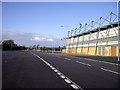
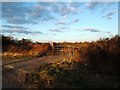
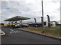
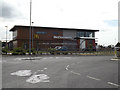
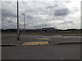
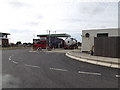
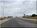
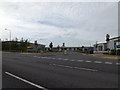
41 photos from this area
Area Information
Key information about the CO4 5YX including its size, population, and administrative classification.
- Area Type
- Postcode
- Area Size
- 20.3 hectares
- Population
- 1671
- Population Density
- 1116 people/km²
House Prices in CO4 5YX
5
Properties
-
Average Sold Price
-
Lowest Price
-
Highest Price
Showing 5 properties
| Address | Type | Beds | Baths | Last Sale Price | Last Sale Date | |
|---|---|---|---|---|---|---|
| Mcdonald's, Mcdonalds Restaurant, Cuckoo Farm Way, Colchester, CO4 5YX | restaurant_cafe | - | - | - | - | |
| Greggs, Unit 14, Northern Gateway Leisure Park, United Way, Colchester, CO4 5YX | restaurant_cafe | - | - | - | - | |
| Fastned, Unit 15, Northern Gateway Leisure Park, United Way, Colchester, CO4 5YX | Retail | - | - | - | - | |
| Wendy's, Unit 13, Northern Gateway Leisure Park, United Way, Colchester, CO4 5YX | restaurant_cafe | - | - | - | - | |
| Marks And Spencer, Bp Garage Colchester Connect, Cuckoo Farm Way, Colchester, CO4 5YX | shop | - | - | - | - |
Energy Efficiency in CO4 5YX
Amenities
Schools
| Rank | School | Type | Entry gender | Ages |
|---|
Explore more schools in this area
Go to Schools tabDemographics
Household Size
Family (3-5 people)
most common
Accommodation Type
Houses
most common
Tenure
71
majority
Ethnic Group
White
most common
Religion
N/A
most common
Household Composition
N/A
most common
Age
47
median
Adults (30-64 years)
most common
Household Deprivation
N/A
with no deprivation
NS-SEC
43
in Lower managerial occupations
Explore more demographic insights in this area
Go to Demographics tabPlanning
Planning Constraints
- Flood RiskPremium
- Ramsar Wetland SitesPremium
- Area of Outstanding Natural BeautyPremium
- Protected Nature ReservePremium
- Protected WoodlandPremium