Area Overview for CO4 5WH
Photos of CO4 5WH
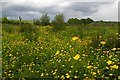
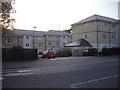
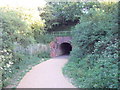
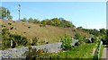
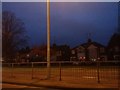
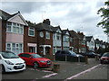
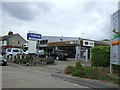
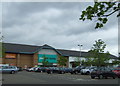
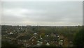
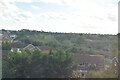
25 photos from this area
Area Information
Key information about the CO4 5WH including its size, population, and administrative classification.
- Area Type
- Postcode
- Area Size
- 7.5 hectares
- Population
- 1706
- Population Density
- 1729 people/km²
House Prices in CO4 5WH
14
Properties
£281,375
Average Sold Price
£125,000
Lowest Price
£495,000
Highest Price
Showing 14 properties
| Address | Type | Beds | Baths | Last Sale Price | Last Sale Date | |
|---|---|---|---|---|---|---|
| Oaklands, 43 Peto Avenue, Colchester, CO4 5WH | house | 4 | - | £495,000 | Nov 2022 | |
| 55 Peto Avenue, Colchester, CO4 5WH | house | - | - | £475,000 | Nov 2020 | |
| 49 Peto Avenue, Colchester, CO4 5WH | house | - | - | £470,000 | Feb 2019 | |
| 39 Peto Avenue, Colchester, CO4 5WH | house | - | - | £327,500 | Nov 2015 | |
| 37 Peto Avenue, Colchester, CO4 5WH | house | 4 | - | £250,000 | Mar 2012 | |
| 45 Peto Avenue, Colchester, CO4 5WH | house | - | - | £279,995 | Dec 2006 | |
| 53 Peto Avenue, Colchester, CO4 5WH | Detached | - | - | £287,500 | May 2004 | |
| 57 Peto Avenue, Colchester, CO4 5WH | Detached | - | - | £218,000 | Jan 2004 | |
| 51 Peto Avenue, Colchester, CO4 5WH | Detached | - | - | £159,000 | Jun 2000 | |
| 35 Peto Avenue, Colchester, CO4 5WH | house | - | - | £148,000 | Aug 1998 |
Page 1 of 2
Energy Efficiency in CO4 5WH
Amenities
Schools
| Rank | School | Type | Entry gender | Ages |
|---|
Explore more schools in this area
Go to Schools tabDemographics
Household Size
Family (3-5 people)
most common
Accommodation Type
Houses
most common
Tenure
70
majority
Ethnic Group
White
most common
Religion
N/A
most common
Household Composition
N/A
most common
Age
47
median
Adults (30-64 years)
most common
Household Deprivation
N/A
with no deprivation
NS-SEC
49
in Lower managerial occupations
Explore more demographic insights in this area
Go to Demographics tabPlanning
Planning Constraints
- Flood RiskPremium
- Ramsar Wetland SitesPremium
- Area of Outstanding Natural BeautyPremium
- Protected Nature ReservePremium
- Protected WoodlandPremium