Area Overview for CO4 5NY
Photos of CO4 5NY
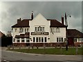
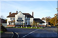
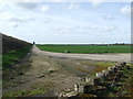
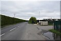

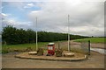

14 photos from this area
Area Information
Key information about the CO4 5NY including its size, population, and administrative classification.
- Area Type
- Postcode
- Area Size
- 24.8 hectares
- Population
- 1367
- Population Density
- 89 people/km²
House Prices in CO4 5NY
29
Properties
£474,436
Average Sold Price
£95,000
Lowest Price
£845,000
Highest Price
Showing 29 properties
| Address | Type | Beds | Baths | Last Sale Price | Last Sale Date | |
|---|---|---|---|---|---|---|
| Oakleigh, Chapel Road, Langham, CO4 5NY | Detached | 5 | 2 | £845,000 | Jul 2022 | |
| Wheatcroft, Chapel Road, Langham, CO4 5NY | Bungalow | 3 | 3 | £595,000 | Feb 2021 | |
| Five Rivers, Chapel Road, Langham, CO4 5NY | Detached | 4 | - | £650,000 | Jan 2021 | |
| Gate House, Chapel Road, Langham, CO4 5NY | Detached | - | - | £680,000 | Jun 2020 | |
| Harvest Cottage, Chapel Road, Langham, CO4 5NY | Detached | 4 | - | £545,000 | Aug 2017 | |
| Ashbrook, Chapel Road, Langham, CO4 5NY | Bungalow | 1 | - | £650,000 | Oct 2015 | |
| Pollyfield, Chapel Road, Langham, CO4 5NY | Bungalow | - | - | £575,000 | May 2012 | |
| Autumn House, Chapel Road, Langham, CO4 5NY | house | 5 | - | £507,599 | Feb 2012 | |
| Jeveck, Chapel Road, Langham, CO4 5NY | Detached | 5 | 3 | £770,000 | Dec 2005 | |
| Glen Croft, Chapel Road, Langham, CO4 5NY | Detached | - | - | £220,500 | Aug 2005 |
Page 1 of 3
Energy Efficiency in CO4 5NY
Amenities
Schools
| Rank | School | Type | Entry gender | Ages |
|---|
Explore more schools in this area
Go to Schools tabDemographics
Household Size
Two person
most common
Accommodation Type
Houses
most common
Tenure
87
majority
Ethnic Group
White
most common
Religion
N/A
most common
Household Composition
N/A
most common
Age
47
median
Adults (30-64 years)
most common
Household Deprivation
N/A
with no deprivation
NS-SEC
47
in Lower managerial occupations
Explore more demographic insights in this area
Go to Demographics tabPlanning
Planning Constraints
- Flood RiskPremium
- Ramsar Wetland SitesPremium
- Area of Outstanding Natural BeautyPremium
- Protected Nature ReservePremium
- Protected WoodlandPremium