Area Overview for CO4 5FN
Photos of CO4 5FN
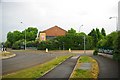

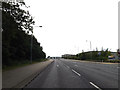
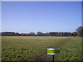
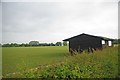
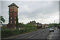
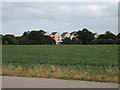
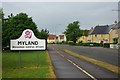
10 photos from this area
Area Information
Key information about the CO4 5FN including its size, population, and administrative classification.
- Area Type
- Postcode
- Area Size
- 1.3 hectares
- Population
- 2074
- Population Density
- 1427 people/km²
House Prices in CO4 5FN
69
Properties
£211,072
Average Sold Price
£97,000
Lowest Price
£450,000
Highest Price
Showing 69 properties
| Address | Type | Beds | Baths | Last Sale Price | Last Sale Date | |
|---|---|---|---|---|---|---|
| 64 Springham Drive, Colchester, CO4 5FN | Terraced | 1 | 1 | £190,000 | Nov 2025 | |
| 71 Springham Drive, Colchester, CO4 5FN | Terraced | 2 | 1 | £241,000 | Sep 2025 | |
| 35 Springham Drive, Colchester, CO4 5FN | Flat | 1 | 1 | £163,000 | Jun 2025 | |
| 29 Springham Drive, Colchester, CO4 5FN | Flat | 1 | 1 | £152,500 | Feb 2025 | |
| 5 Springham Drive, Colchester, CO4 5FN | Flat | - | - | £173,000 | Aug 2024 | |
| 30 Springham Drive, Colchester, CO4 5FN | Semi-detached | 4 | 3 | £415,000 | Jul 2024 | |
| 3 Springham Drive, Colchester, CO4 5FN | Flat | - | - | £135,000 | Jul 2023 | |
| 7 Springham Drive, Colchester, CO4 5FN | Retail | 1 | 1 | £120,000 | Jun 2023 | |
| 39 Springham Drive, Colchester, CO4 5FN | Flat | 2 | 1 | £180,000 | Jul 2022 | |
| 11 Springham Drive, Colchester, CO4 5FN | Flat | 2 | 1 | £170,000 | Dec 2021 |
Page 1 of 7
Energy Efficiency in CO4 5FN
Amenities
Schools
| Rank | School | Type | Entry gender | Ages |
|---|
Explore more schools in this area
Go to Schools tabDemographics
Household Size
Family (3-5 people)
most common
Accommodation Type
Houses
most common
Tenure
55
majority
Ethnic Group
White
most common
Religion
N/A
most common
Household Composition
N/A
most common
Age
47
median
Adults (30-64 years)
most common
Household Deprivation
N/A
with no deprivation
NS-SEC
37
in Lower managerial occupations
Explore more demographic insights in this area
Go to Demographics tabPlanning
Planning Constraints
- Flood RiskPremium
- Ramsar Wetland SitesPremium
- Area of Outstanding Natural BeautyPremium
- Protected Nature ReservePremium
- Protected WoodlandPremium