Area Overview for CO4 3TH
Photos of CO4 3TH
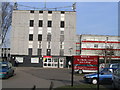
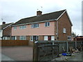
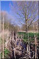
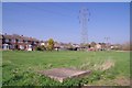
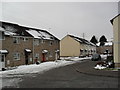
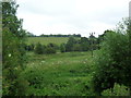
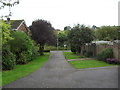
11 photos from this area
Area Information
Key information about the CO4 3TH including its size, population, and administrative classification.
- Area Type
- Postcode
- Area Size
- 7765 m²
- Population
- 1550
- Population Density
- 7820 people/km²
House Prices in CO4 3TH
31
Properties
£133,600
Average Sold Price
£52,000
Lowest Price
£270,000
Highest Price
Showing 31 properties
| Address | Type | Beds | Baths | Last Sale Price | Last Sale Date | |
|---|---|---|---|---|---|---|
| 32 Thorpe Walk, Colchester, CO4 3TH | house | 4 | 1 | £270,000 | Aug 2023 | |
| 27 Thorpe Walk, Colchester, CO4 3TH | house | - | - | £231,000 | Mar 2021 | |
| 21 Thorpe Walk, Colchester, CO4 3TH | Terraced | 3 | - | £205,000 | Aug 2016 | |
| 9 Thorpe Walk, Colchester, CO4 3TH | Terraced | 3 | 1 | £141,000 | Jul 2011 | |
| 8 Thorpe Walk, Colchester, CO4 3TH | Flat | - | - | £61,000 | Jan 2007 | |
| 14 Thorpe Walk, Colchester, CO4 3TH | Flat | - | - | £95,000 | Jul 2005 | |
| 28 Thorpe Walk, Colchester, CO4 3TH | Terraced | 3 | 1 | £120,000 | Dec 2004 | |
| 17 Thorpe Walk, Colchester, CO4 3TH | Semi-detached | 3 | 1 | £92,000 | Jun 2002 | |
| 11 Thorpe Walk, Colchester, CO4 3TH | Terraced | 6 | 2 | £52,000 | Aug 2000 | |
| 19 Thorpe Walk, Colchester, CO4 3TH | Terraced | - | - | £69,000 | Dec 1999 |
Page 1 of 4
Energy Efficiency in CO4 3TH
Amenities
Schools
| Rank | School | Type | Entry gender | Ages |
|---|
Explore more schools in this area
Go to Schools tabDemographics
Household Size
Family (3-5 people)
most common
Accommodation Type
Houses
most common
Tenure
41
majority
Ethnic Group
White
most common
Religion
N/A
most common
Household Composition
N/A
most common
Age
22
median
Young Adults (15-29 years)
most common
Household Deprivation
N/A
with no deprivation
NS-SEC
11
in Lower managerial occupations
Explore more demographic insights in this area
Go to Demographics tabPlanning
Planning Constraints
- Flood RiskPremium
- Ramsar Wetland SitesPremium
- Area of Outstanding Natural BeautyPremium
- Protected Nature ReservePremium
- Protected WoodlandPremium