Area Overview for CO4 3ET
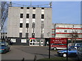
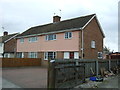
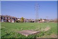
Photos of CO4 3ET


Area Information
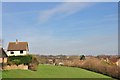
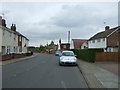
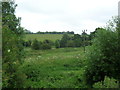
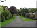
CO4 3ET is a small, tightly knit residential cluster within Colchester’s eastern suburbs, part of the historically named Greenstead-juxta-Colchester. With a population of 1,552, it is a compact area characterised by its proximity to Colchester’s urban core and its roots in medieval land disputes. The community sits near Greenstead Community Centre, a hub built on a former petrol station site, and close to St. Edmund’s church hall, which serves dual purposes. Daily life here is shaped by its proximity to rail networks, with Hythe and Colchester Town stations offering regular commuter links. The area’s small size means it is not a sprawling suburb but a focused cluster of homes, many of which are flats. Its historical ties to Colchester’s 13th-century manor courts and 17th-century siege history add a layer of local identity, though modern residents are more likely to frequent nearby shops like Tesco Colchester and East of England Co-operative Co. The mix of historical and contemporary elements creates a distinct character, blending practicality with a sense of rootedness in the region’s past.
- Area Type
- Postcode
- Area Size
- Not available
- Population
- 1552
- Population Density
- 5681 people/km²
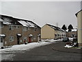
The property market in CO4 3ET is dominated by rental units, with only 22% of homes owned by residents. This low home ownership rate indicates a market where most properties are occupied by tenants, likely attracting professionals or families seeking short-term or flexible housing. The accommodation type is primarily flats, which suits the area’s compact nature and smaller household sizes. This configuration suggests limited scope for large family homes or multi-generational living, making the area more suitable for individuals or couples. For buyers, the small size of CO4 3ET means the housing stock is constrained, and those seeking property may need to look beyond the immediate postcode to nearby areas. The prevalence of flats also implies a focus on convenience and accessibility over expansive living spaces, aligning with the area’s proximity to rail networks and retail hubs.
House Prices in CO4 3ET
No properties found in this postcode.
Energy Efficiency in CO4 3ET
Living in CO4 3ET offers a blend of practical convenience and local character. The area’s retail options include well-known names like Tesco Colchester and East of England Co-operative Co, providing everyday essentials within reach. Rail connectivity is a key feature, with five stations—including Colchester Railway Station—offering frequent services to the city and surrounding areas. The Greenstead Community Centre, built on a former petrol station site, hosts events and social activities, fostering a sense of local cohesion. Nearby, St. Edmund’s church hall and historical sites like Gallow Green add cultural and historical depth. While the area is small, its proximity to Colchester’s amenities ensures residents can access dining, leisure, and shopping without long commutes. The mix of modern convenience and historical elements creates a lifestyle that balances practicality with a touch of local heritage.
Amenities
Schools
| Rank | School | Type | Entry gender | Ages |
|---|
Explore more schools in this area
Go to Schools tabDemographics
The population of CO4 3ET has a median age of 47, with the majority of residents falling within the 30-64 age range. This suggests a community of middle-aged adults, likely including professionals, families, and retirees. Home ownership is low at 22%, indicating that most residents rent their homes. The predominant accommodation type is flats, reflecting a housing stock tailored to smaller households or those seeking rental flexibility. The predominant ethnic group is White, with no data provided on other demographic groups. The low home ownership rate may influence the local property market, making it more rental-focused. For quality of life, this demographic profile suggests a stable, mature community with established routines, though the limited home ownership could affect long-term investment opportunities. The absence of specific data on deprivation or diversity means these factors are not quantified here, but the age and ownership figures provide a clear snapshot of the area’s social fabric.
Household Size
Accommodation Type
Tenure
Ethnic Group
Religion
Household Composition
Age
Household Deprivation
NS-SEC
Explore more demographic insights in this area
Go to Demographics tabPlanning
Planning Constraints
- Flood RiskPremium
- Ramsar Wetland SitesPremium
- Area of Outstanding Natural BeautyPremium
- Protected Nature ReservePremium
- Protected WoodlandPremium