Area Overview for CO4 0JR
Photos of CO4 0JR
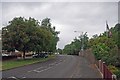
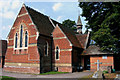

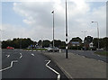
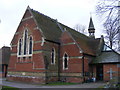
26 photos from this area
Area Information
Key information about the CO4 0JR including its size, population, and administrative classification.
- Area Type
- Postcode
- Area Size
- 1.7 hectares
- Population
- 2315
- Population Density
- 2783 people/km²
House Prices in CO4 0JR
21
Properties
£304,278
Average Sold Price
£165,000
Lowest Price
£550,000
Highest Price
Showing 21 properties
| Address | Type | Beds | Baths | Last Sale Price | Last Sale Date | |
|---|---|---|---|---|---|---|
| 307 St Johns Road, Colchester, CO4 0JR | Bungalow | - | - | £415,000 | Mar 2022 | |
| 206 St Johns Road, Colchester, CO4 0JR | Detached | 9 | 2 | £550,000 | Sep 2021 | |
| 327 St Johns Road, Colchester, CO4 0JR | house | 4 | - | £340,000 | Jan 2021 | |
| 309 St Johns Road, Colchester, CO4 0JR | house | 3 | 1 | £320,000 | Aug 2019 | |
| 321A St Johns Road, Colchester, CO4 0JR | Detached | 3 | 1 | £186,000 | Jun 2018 | |
| 315 St Johns Road, Colchester, CO4 0JR | Detached | 4 | 1 | £319,500 | Feb 2016 | |
| 204 St Johns Road, Colchester, CO4 0JR | house | 3 | 1 | £165,000 | Jun 2009 | |
| 202 St Johns Road, Colchester, CO4 0JR | Terraced | - | - | £230,000 | Dec 2006 | |
| 313 St Johns Road, Colchester, CO4 0JR | Detached | - | - | £213,000 | Nov 2002 | |
| 321 St Johns Road, Colchester, CO4 0JR | Semi-detached | 3 | 1 | - | - |
Page 1 of 3
Energy Efficiency in CO4 0JR
Amenities
Schools
| Rank | School | Type | Entry gender | Ages |
|---|
Explore more schools in this area
Go to Schools tabDemographics
Household Size
Two person
most common
Accommodation Type
Houses
most common
Tenure
89
majority
Ethnic Group
White
most common
Religion
N/A
most common
Household Composition
N/A
most common
Age
47
median
Adults (30-64 years)
most common
Household Deprivation
N/A
with no deprivation
NS-SEC
39
in Lower managerial occupations
Explore more demographic insights in this area
Go to Demographics tabPlanning
Planning Constraints
- Flood RiskPremium
- Ramsar Wetland SitesPremium
- Area of Outstanding Natural BeautyPremium
- Protected Nature ReservePremium
- Protected WoodlandPremium