Area Overview for CO4 0HQ
Photos of CO4 0HQ
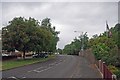
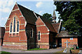

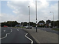
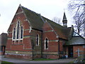
26 photos from this area
Area Information
Key information about the CO4 0HQ including its size, population, and administrative classification.
- Area Type
- Postcode
- Area Size
- 1.3 hectares
- Population
- 2315
- Population Density
- 2783 people/km²
House Prices in CO4 0HQ
16
Properties
£306,833
Average Sold Price
£143,000
Lowest Price
£600,000
Highest Price
Showing 16 properties
| Address | Type | Beds | Baths | Last Sale Price | Last Sale Date | |
|---|---|---|---|---|---|---|
| 467 Ipswich Road, Colchester, CO4 0HQ | Semi-detached | 3 | 1 | £355,000 | Nov 2024 | |
| 477 Ipswich Road, Colchester, CO4 0HQ | Semi-detached | 3 | 1 | £355,000 | Aug 2024 | |
| 459 Ipswich Road, Colchester, CO4 0HQ | house | - | - | £327,500 | Aug 2022 | |
| 461 Ipswich Road, Colchester, CO4 0HQ | Retail | 3 | 1 | £355,000 | Jul 2022 | |
| 481 Ipswich Road, Colchester, CO4 0HQ | house | 4 | 2 | £600,000 | Sep 2021 | |
| 463 Ipswich Road, Colchester, CO4 0HQ | Detached | 4 | 1 | £232,000 | Dec 2019 | |
| 487 Ipswich Road, Colchester, CO4 0HQ | Bungalow | 5 | - | £414,000 | Sep 2017 | |
| 455 Ipswich Road, Colchester, CO4 0HQ | Detached | 4 | 2 | £350,000 | Jul 2014 | |
| 473 Ipswich Road, Colchester, CO4 0HQ | house | 3 | 1 | £198,000 | Jul 2012 | |
| 465 Ipswich Road, Colchester, CO4 0HQ | Semi-detached | - | - | £183,500 | Jan 2007 |
Page 1 of 2
Energy Efficiency in CO4 0HQ
Amenities
Schools
| Rank | School | Type | Entry gender | Ages |
|---|
Explore more schools in this area
Go to Schools tabDemographics
Household Size
Two person
most common
Accommodation Type
Houses
most common
Tenure
89
majority
Ethnic Group
White
most common
Religion
N/A
most common
Household Composition
N/A
most common
Age
47
median
Adults (30-64 years)
most common
Household Deprivation
N/A
with no deprivation
NS-SEC
39
in Lower managerial occupations
Explore more demographic insights in this area
Go to Demographics tabPlanning
Planning Constraints
- Flood RiskPremium
- Ramsar Wetland SitesPremium
- Area of Outstanding Natural BeautyPremium
- Protected Nature ReservePremium
- Protected WoodlandPremium