Area Overview for CO4 0EY
Photos of CO4 0EY
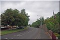


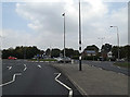
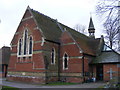
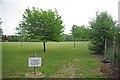
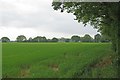
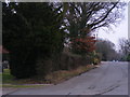


26 photos from this area
Area Information
Key information about the CO4 0EY including its size, population, and administrative classification.
- Area Type
- Postcode
- Area Size
- 9673 m²
- Population
- 1445
- Population Density
- 4657 people/km²
House Prices in CO4 0EY
17
Properties
£249,207
Average Sold Price
£120,000
Lowest Price
£455,000
Highest Price
Showing 17 properties
| Address | Type | Beds | Baths | Last Sale Price | Last Sale Date | |
|---|---|---|---|---|---|---|
| 396 Ipswich Road, Colchester, CO4 0EY | Semi-detached | 4 | 2 | £455,000 | Oct 2024 | |
| 446 Ipswich Road, Colchester, CO4 0EY | Semi-detached | 3 | 1 | £390,000 | Dec 2023 | |
| 448 Ipswich Road, Colchester, CO4 0EY | Retail | 3 | 2 | £367,400 | Nov 2022 | |
| 450 Ipswich Road, Colchester, CO4 0EY | Semi-detached | 3 | 1 | £337,500 | Jun 2021 | |
| 454 Ipswich Road, Colchester, CO4 0EY | house | - | - | £258,000 | Oct 2019 | |
| 408 Ipswich Road, Colchester, CO4 0EY | Detached | 4 | - | £290,000 | Nov 2014 | |
| 452 Ipswich Road, Colchester, CO4 0EY | house | 3 | - | £194,000 | Jul 2010 | |
| 402 Ipswich Road, Colchester, CO4 0EY | Detached | - | - | £205,000 | Apr 2008 | |
| 404 Ipswich Road, Colchester, CO4 0EY | Detached | - | - | £220,000 | Jan 2008 | |
| 458 Ipswich Road, Colchester, CO4 0EY | Terraced | - | - | £179,995 | Aug 2004 |
Page 1 of 2
Energy Efficiency in CO4 0EY
Amenities
Schools
| Rank | School | Type | Entry gender | Ages |
|---|
Explore more schools in this area
Go to Schools tabDemographics
Household Size
Family (3-5 people)
most common
Accommodation Type
Houses
most common
Tenure
57
majority
Ethnic Group
White
most common
Religion
N/A
most common
Household Composition
N/A
most common
Age
47
median
Adults (30-64 years)
most common
Household Deprivation
N/A
with no deprivation
NS-SEC
35
in Lower managerial occupations
Explore more demographic insights in this area
Go to Demographics tabPlanning
Planning Constraints
- Flood RiskPremium
- Ramsar Wetland SitesPremium
- Area of Outstanding Natural BeautyPremium
- Protected Nature ReservePremium
- Protected WoodlandPremium