Area Overview for CO4 0EW
Photos of CO4 0EW
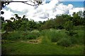
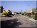
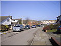
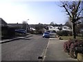
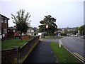
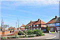
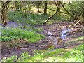
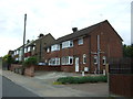
38 photos from this area
Area Information
Key information about the CO4 0EW including its size, population, and administrative classification.
- Area Type
- Postcode
- Area Size
- 1.8 hectares
- Population
- 1492
- Population Density
- 3810 people/km²
House Prices in CO4 0EW
25
Properties
£288,722
Average Sold Price
£60,000
Lowest Price
£540,000
Highest Price
Showing 25 properties
| Address | Type | Beds | Baths | Last Sale Price | Last Sale Date | |
|---|---|---|---|---|---|---|
| Winterberries, 263 Ipswich Road, Colchester, CO4 0EW | Semi-detached | 3 | 2 | £400,000 | Nov 2022 | |
| 233 Ipswich Road, Colchester, CO4 0EW | Semi-detached | 3 | 1 | £317,500 | Dec 2021 | |
| 265 Ipswich Road, Colchester, CO4 0EW | Semi-detached | 4 | 2 | £364,000 | Nov 2020 | |
| 267 Ipswich Road, Colchester, CO4 0EW | Semi-detached | 4 | 2 | £355,000 | May 2020 | |
| 277 Ipswich Road, Colchester, CO4 0EW | Detached | 4 | 2 | £540,000 | Jun 2019 | |
| 255 Ipswich Road, Colchester, CO4 0EW | Semi-detached | 5 | 2 | £485,000 | Oct 2018 | |
| 231 Ipswich Road, Colchester, CO4 0EW | Detached | 4 | 2 | £313,000 | Sep 2018 | |
| 275 Ipswich Road, Colchester, CO4 0EW | Detached | 4 | 3 | £360,000 | Mar 2018 | |
| 269 Ipswich Road, Colchester, CO4 0EW | Semi-detached | 3 | 2 | £335,000 | Feb 2018 | |
| 239 Ipswich Road, Colchester, CO4 0EW | Detached | 5 | - | £356,000 | Feb 2015 |
Page 1 of 3
Energy Efficiency in CO4 0EW
Amenities
Schools
| Rank | School | Type | Entry gender | Ages |
|---|
Explore more schools in this area
Go to Schools tabDemographics
Household Size
Two person
most common
Accommodation Type
Houses
most common
Tenure
88
majority
Ethnic Group
White
most common
Religion
N/A
most common
Household Composition
N/A
most common
Age
47
median
Adults (30-64 years)
most common
Household Deprivation
N/A
with no deprivation
NS-SEC
31
in Lower managerial occupations
Explore more demographic insights in this area
Go to Demographics tabPlanning
Planning Constraints
- Flood RiskPremium
- Ramsar Wetland SitesPremium
- Area of Outstanding Natural BeautyPremium
- Protected Nature ReservePremium
- Protected WoodlandPremium