Area Overview for CO3 0SJ
Photos of CO3 0SJ
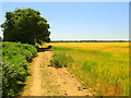
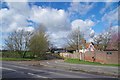
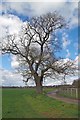
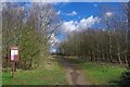
15 photos from this area
Area Information
Key information about the CO3 0SJ including its size, population, and administrative classification.
- Area Type
- Postcode
- Area Size
- 1.2 km²
- Population
- 1978
- Population Density
- 384 people/km²
House Prices in CO3 0SJ
10
Properties
£435,000
Average Sold Price
£92,000
Lowest Price
£900,000
Highest Price
Showing 10 properties
| Address | Type | Beds | Baths | Last Sale Price | Last Sale Date | |
|---|---|---|---|---|---|---|
| Randoms, Maldon Road, Stanway, CO3 0SJ | Bungalow | 3 | 3 | £600,000 | May 2023 | |
| Hillview, Maldon Road, Stanway, CO3 0SJ | Bungalow | 4 | 2 | £565,000 | Oct 2022 | |
| Fairdawn, Maldon Road, Stanway, CO3 0SJ | Bungalow | 3 | 1 | £900,000 | Jul 2021 | |
| Draw Well, Maldon Road, Stanway, CO3 0SJ | Bungalow | 3 | - | £333,000 | Dec 2009 | |
| Well House, Maldon Road, Stanway, CO3 0SJ | Detached | - | - | £460,000 | May 2004 | |
| Floradora, Maldon Road, Stanway, CO3 0SJ | Detached | - | - | £95,000 | Jun 1998 | |
| Oaklea, Maldon Road, Stanway, CO3 0SJ | Bungalow | - | - | £92,000 | Nov 1997 | |
| Annexe, Draw Well, Maldon Road, Stanway, CO3 0SJ | Flat | - | - | - | - | |
| Shaw Park, Maldon Road, Stanway, CO3 0SJ | Detached | - | - | - | - | |
| Springfield, Maldon Road, Stanway, CO3 0SJ | Detached | - | - | - | - |
Energy Efficiency in CO3 0SJ
Amenities
Schools
| Rank | School | Type | Entry gender | Ages |
|---|
Explore more schools in this area
Go to Schools tabDemographics
Household Size
Family (3-5 people)
most common
Accommodation Type
Houses
most common
Tenure
84
majority
Ethnic Group
White
most common
Religion
N/A
most common
Household Composition
N/A
most common
Age
47
median
Adults (30-64 years)
most common
Household Deprivation
N/A
with no deprivation
NS-SEC
36
in Lower managerial occupations
Explore more demographic insights in this area
Go to Demographics tabPlanning
Planning Constraints
- Flood RiskPremium
- Ramsar Wetland SitesPremium
- Area of Outstanding Natural BeautyPremium
- Protected Nature ReservePremium
- Protected WoodlandPremium