Area Overview for CO3 0RQ
Photos of CO3 0RQ

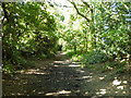
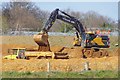
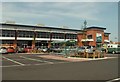
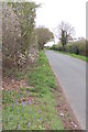
6 photos from this area
Area Information
Key information about the CO3 0RQ including its size, population, and administrative classification.
- Area Type
- Postcode
- Area Size
- 1.3 hectares
- Population
- 1978
- Population Density
- 384 people/km²
House Prices in CO3 0RQ
26
Properties
£291,161
Average Sold Price
£194,950
Lowest Price
£380,000
Highest Price
Showing 26 properties
| Address | Type | Beds | Baths | Last Sale Price | Last Sale Date | |
|---|---|---|---|---|---|---|
| 14 Weyland Drive, Stanway, CO3 0RQ | Terraced | 3 | - | £283,000 | Oct 2025 | |
| 20 Weyland Drive, Stanway, CO3 0RQ | Terraced | 3 | 1 | £305,000 | Mar 2024 | |
| 10 Weyland Drive, Stanway, CO3 0RQ | Semi-detached | 3 | 2 | £245,000 | Dec 2019 | |
| 6 Weyland Drive, Stanway, CO3 0RQ | Semi-detached | 5 | 2 | £346,000 | Jul 2019 | |
| 18 Weyland Drive, Stanway, CO3 0RQ | Terraced | 3 | 3 | £270,000 | Jul 2019 | |
| 16 Weyland Drive, Stanway, CO3 0RQ | Semi-detached | 3 | 3 | £246,500 | Dec 2018 | |
| 2 Weyland Drive, Stanway, CO3 0RQ | house | 4 | - | £350,000 | Dec 2015 | |
| 4 Weyland Drive, Stanway, CO3 0RQ | Terraced | - | - | £380,000 | Jun 2008 | |
| 8 Weyland Drive, Stanway, CO3 0RQ | Terraced | - | - | £194,950 | Jun 2008 | |
| 38 Weyland Drive, Stanway, CO3 0RQ | Flat | 4 | - | - | - |
Page 1 of 3
Energy Efficiency in CO3 0RQ
Amenities
Schools
| Rank | School | Type | Entry gender | Ages |
|---|
Explore more schools in this area
Go to Schools tabDemographics
Household Size
Family (3-5 people)
most common
Accommodation Type
Houses
most common
Tenure
84
majority
Ethnic Group
White
most common
Religion
N/A
most common
Household Composition
N/A
most common
Age
47
median
Adults (30-64 years)
most common
Household Deprivation
N/A
with no deprivation
NS-SEC
36
in Lower managerial occupations
Explore more demographic insights in this area
Go to Demographics tabPlanning
Planning Constraints
- Flood RiskPremium
- Ramsar Wetland SitesPremium
- Area of Outstanding Natural BeautyPremium
- Protected Nature ReservePremium
- Protected WoodlandPremium