Area Overview for CO2 9DR
Photos of CO2 9DR
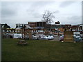
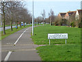
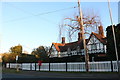
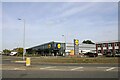
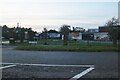
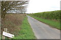
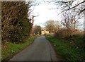
7 photos from this area
Area Information
Key information about the CO2 9DR including its size, population, and administrative classification.
- Area Type
- Postcode
- Area Size
- 8441 m²
- Population
- 1506
- Population Density
- 1795 people/km²
House Prices in CO2 9DR
17
Properties
£160,042
Average Sold Price
£50,000
Lowest Price
£275,000
Highest Price
Showing 17 properties
| Address | Type | Beds | Baths | Last Sale Price | Last Sale Date | |
|---|---|---|---|---|---|---|
| 5 Hazell Avenue, Colchester, CO2 9DR | Terraced | 3 | 1 | £275,000 | Mar 2022 | |
| 7 Hazell Avenue, Colchester, CO2 9DR | Terraced | 3 | 1 | £260,000 | Jul 2021 | |
| 1 Hazell Avenue, Colchester, CO2 9DR | Terraced | 3 | 1 | £270,000 | Dec 2019 | |
| 21 Hazell Avenue, Colchester, CO2 9DR | Maisonette | 2 | 1 | £178,000 | Aug 2018 | |
| 21A Hazell Avenue, Colchester, CO2 9DR | Maisonette | 2 | 1 | £175,000 | Aug 2018 | |
| 19 Hazell Avenue, Colchester, CO2 9DR | house | - | - | £166,000 | Jul 2014 | |
| 11 Hazell Avenue, Colchester, CO2 9DR | Maisonette | - | - | £93,000 | Jun 2013 | |
| 6 Hazell Avenue, Colchester, CO2 9DR | Semi-detached | 3 | - | £162,500 | Oct 2010 | |
| 13 Hazell Avenue, Colchester, CO2 9DR | Maisonette | - | - | £80,000 | Mar 2009 | |
| 8 Hazell Avenue, Colchester, CO2 9DR | Terraced | - | - | £150,000 | Dec 2007 |
Page 1 of 2
Energy Efficiency in CO2 9DR
Amenities
Schools
| Rank | School | Type | Entry gender | Ages |
|---|
Explore more schools in this area
Go to Schools tabDemographics
Household Size
Family (3-5 people)
most common
Accommodation Type
Houses
most common
Tenure
68
majority
Ethnic Group
White
most common
Religion
N/A
most common
Household Composition
N/A
most common
Age
47
median
Adults (30-64 years)
most common
Household Deprivation
N/A
with no deprivation
NS-SEC
33
in Lower managerial occupations
Explore more demographic insights in this area
Go to Demographics tabPlanning
Planning Constraints
- Flood RiskPremium
- Ramsar Wetland SitesPremium
- Area of Outstanding Natural BeautyPremium
- Protected Nature ReservePremium
- Protected WoodlandPremium