Area Overview for CO2 8PP
Photos of CO2 8PP
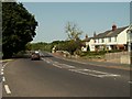


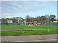
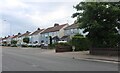

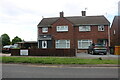
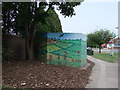
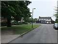
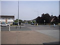
13 photos from this area
Area Information
Key information about the CO2 8PP including its size, population, and administrative classification.
- Area Type
- Postcode
- Area Size
- 9816 m²
- Population
- 1529
- Population Density
- 5050 people/km²
House Prices in CO2 8PP
19
Properties
£269,833
Average Sold Price
£112,000
Lowest Price
£495,000
Highest Price
Showing 19 properties
| Address | Type | Beds | Baths | Last Sale Price | Last Sale Date | |
|---|---|---|---|---|---|---|
| 265 Mersea Road, Colchester, CO2 8PP | Semi-detached | 4 | 1 | £495,000 | Sep 2025 | |
| 281 Mersea Road, Colchester, CO2 8PP | Bungalow | 3 | - | £350,000 | Jun 2021 | |
| 275 Mersea Road, Colchester, CO2 8PP | house | - | - | £377,000 | Oct 2020 | |
| 267 Mersea Road, Colchester, CO2 8PP | Semi-detached | 3 | 2 | £315,000 | May 2018 | |
| 271 Mersea Road, Colchester, CO2 8PP | Semi-detached | - | - | £240,000 | Feb 2018 | |
| 269 Mersea Road, Colchester, CO2 8PP | Semi-detached | 3 | - | £250,000 | May 2016 | |
| 287 Mersea Road, Colchester, CO2 8PP | Semi-detached | 5 | - | £320,000 | May 2015 | |
| 273 Mersea Road, Colchester, CO2 8PP | house | - | - | £239,995 | Jan 2013 | |
| 259 Mersea Road, Colchester, CO2 8PP | Detached | - | - | £230,000 | Nov 2004 | |
| 283 Mersea Road, Colchester, CO2 8PP | Detached | 2 | 1 | £163,000 | Oct 2004 |
Page 1 of 2
Energy Efficiency in CO2 8PP
Amenities
Schools
| Rank | School | Type | Entry gender | Ages |
|---|
Explore more schools in this area
Go to Schools tabDemographics
Household Size
Family (3-5 people)
most common
Accommodation Type
Houses
most common
Tenure
70
majority
Ethnic Group
White
most common
Religion
N/A
most common
Household Composition
N/A
most common
Age
47
median
Adults (30-64 years)
most common
Household Deprivation
N/A
with no deprivation
NS-SEC
25
in Lower managerial occupations
Explore more demographic insights in this area
Go to Demographics tabPlanning
Planning Constraints
- Flood RiskPremium
- Ramsar Wetland SitesPremium
- Area of Outstanding Natural BeautyPremium
- Protected Nature ReservePremium
- Protected WoodlandPremium