Area Overview for CO2 8EA
Photos of CO2 8EA
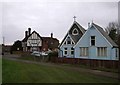
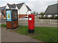
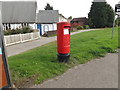
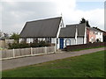
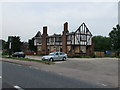
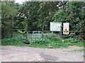
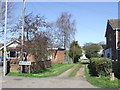
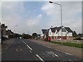
16 photos from this area
Area Information
Key information about the CO2 8EA including its size, population, and administrative classification.
- Area Type
- Postcode
- Area Size
- 5107 m²
- Population
- 1542
- Population Density
- 522 people/km²
House Prices in CO2 8EA
16
Properties
£180,661
Average Sold Price
£106,000
Lowest Price
£315,000
Highest Price
Showing 16 properties
| Address | Type | Beds | Baths | Last Sale Price | Last Sale Date | |
|---|---|---|---|---|---|---|
| 7 Fingringhoe Road, Colchester, CO2 8EA | Terraced | 2 | 1 | £245,000 | Oct 2025 | |
| 17 Fingringhoe Road, Colchester, CO2 8EA | house | - | - | £315,000 | Mar 2022 | |
| 11 Fingringhoe Road, Colchester, CO2 8EA | Semi-detached | 2 | 1 | £190,000 | Aug 2020 | |
| 35 Fingringhoe Road, Colchester, CO2 8EA | Semi-detached | 3 | 1 | £211,000 | May 2019 | |
| 25 Fingringhoe Road, Colchester, CO2 8EA | Semi-detached | 3 | 2 | £184,000 | Sep 2016 | |
| 3 Fingringhoe Road, Colchester, CO2 8EA | Terraced | 2 | - | £144,950 | Sep 2013 | |
| 27 Fingringhoe Road, Colchester, CO2 8EA | Semi-detached | 2 | 1 | £115,000 | Sep 2011 | |
| 5 Fingringhoe Road, Colchester, CO2 8EA | house | - | - | £106,000 | Jul 2004 | |
| 9 Fingringhoe Road, Colchester, CO2 8EA | Terraced | - | - | £115,000 | Mar 2004 | |
| 13 Fingringhoe Road, Colchester, CO2 8EA | Land | - | - | - | - |
Page 1 of 2
Energy Efficiency in CO2 8EA
Amenities
Schools
| Rank | School | Type | Entry gender | Ages |
|---|
Explore more schools in this area
Go to Schools tabDemographics
Household Size
Family (3-5 people)
most common
Accommodation Type
Houses
most common
Tenure
55
majority
Ethnic Group
White
most common
Religion
N/A
most common
Household Composition
N/A
most common
Age
47
median
Adults (30-64 years)
most common
Household Deprivation
N/A
with no deprivation
NS-SEC
24
in Lower managerial occupations
Explore more demographic insights in this area
Go to Demographics tabPlanning
Planning Constraints
- Flood RiskPremium
- Ramsar Wetland SitesPremium
- Area of Outstanding Natural BeautyPremium
- Protected Nature ReservePremium
- Protected WoodlandPremium