Area Overview for CO2 8BX
Photos of CO2 8BX
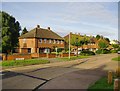
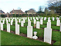
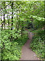
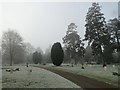
50 photos from this area
Area Information
Key information about the CO2 8BX including its size, population, and administrative classification.
- Area Type
- Postcode
- Area Size
- 1.2 hectares
- Population
- 1295
- Population Density
- 4586 people/km²
House Prices in CO2 8BX
65
Properties
£129,958
Average Sold Price
£31,500
Lowest Price
£337,000
Highest Price
Showing 65 properties
| Address | Type | Beds | Baths | Last Sale Price | Last Sale Date | |
|---|---|---|---|---|---|---|
| 37 Flanders Field, Colchester, CO2 8BX | Terraced | 2 | 1 | £249,000 | May 2025 | |
| 45 Flanders Field, Colchester, CO2 8BX | Terraced | 2 | 1 | £225,000 | Apr 2025 | |
| 38 Flanders Field, Colchester, CO2 8BX | Flat | - | - | £133,500 | Feb 2025 | |
| 16 Flanders Field, Colchester, CO2 8BX | Flat | - | - | £147,500 | May 2024 | |
| 12 Flanders Field, Colchester, CO2 8BX | Flat | - | - | £140,000 | Aug 2023 | |
| 36 Flanders Field, Colchester, CO2 8BX | Flat | - | - | £125,000 | Jun 2023 | |
| 74 Flanders Field, Colchester, CO2 8BX | Flat | 1 | 1 | £105,000 | Dec 2021 | |
| 11 Flanders Field, Colchester, CO2 8BX | house | - | - | £260,000 | Aug 2021 | |
| 21 Flanders Field, Colchester, CO2 8BX | house | - | - | £264,000 | Jul 2021 | |
| 24 Flanders Field, Colchester, CO2 8BX | Flat | - | - | £77,500 | Jun 2021 |
Page 1 of 7
Energy Efficiency in CO2 8BX
Amenities
Schools
| Rank | School | Type | Entry gender | Ages |
|---|
Explore more schools in this area
Go to Schools tabDemographics
Household Size
One person
most common
Accommodation Type
Houses
most common
Tenure
59
majority
Ethnic Group
White
most common
Religion
N/A
most common
Household Composition
N/A
most common
Age
47
median
Adults (30-64 years)
most common
Household Deprivation
N/A
with no deprivation
NS-SEC
28
in Lower managerial occupations
Explore more demographic insights in this area
Go to Demographics tabPlanning
Planning Constraints
- Flood RiskPremium
- Ramsar Wetland SitesPremium
- Area of Outstanding Natural BeautyPremium
- Protected Nature ReservePremium
- Protected WoodlandPremium