Area Overview for CO2 0JU
Photos of CO2 0JU

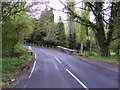
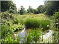
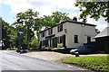
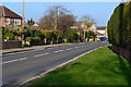
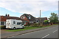

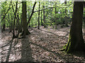

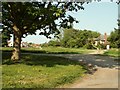

13 photos from this area
Area Information
Key information about the CO2 0JU including its size, population, and administrative classification.
- Area Type
- Postcode
- Area Size
- 8.7 hectares
- Population
- 1468
- Population Density
- 907 people/km²
House Prices in CO2 0JU
27
Properties
£378,750
Average Sold Price
£137,500
Lowest Price
£695,000
Highest Price
Showing 27 properties
| Address | Type | Beds | Baths | Last Sale Price | Last Sale Date | |
|---|---|---|---|---|---|---|
| Homeleigh, Abberton Road, Layer De La Haye, CO2 0JU | Retail | 3 | 2 | £510,000 | Jun 2022 | |
| Hawthorn, Abberton Road, Layer De La Haye, CO2 0JU | Bungalow | - | - | £695,000 | Aug 2021 | |
| Lairdanite, Abberton Road, Layer De La Haye, CO2 0JU | house | - | - | £677,500 | Oct 2018 | |
| Sandilands, Abberton Road, Layer De La Haye, CO2 0JU | Bungalow | - | - | £365,000 | Nov 2016 | |
| Sunnyside, Abberton Road, Layer De La Haye, CO2 0JU | Bungalow | 2 | - | £240,000 | Apr 2015 | |
| West Wind, Abberton Road, Layer De La Haye, CO2 0JU | Semi-detached | - | - | £210,000 | Jul 2013 | |
| 5, Upper Cottages, Abberton Road, Layer De La Haye, CO2 0JU | house | 3 | - | £195,000 | Aug 2011 | |
| Apple Cottage, Abberton Road, Layer De La Haye, CO2 0JU | Detached | - | - | £137,500 | Mar 1997 | |
| 2, Upper Cottages, Abberton Road, Layer De La Haye, CO2 0JU | Semi-detached | 3 | 1 | - | - | |
| 1, Upper Cottages, Abberton Road, Layer De La Haye, CO2 0JU | Semi-detached | 3 | 2 | - | - |
Page 1 of 3
Energy Efficiency in CO2 0JU
Amenities
Schools
| Rank | School | Type | Entry gender | Ages |
|---|
Explore more schools in this area
Go to Schools tabDemographics
Household Size
Two person
most common
Accommodation Type
Houses
most common
Tenure
90
majority
Ethnic Group
White
most common
Religion
N/A
most common
Household Composition
N/A
most common
Age
47
median
Adults (30-64 years)
most common
Household Deprivation
N/A
with no deprivation
NS-SEC
43
in Lower managerial occupations
Explore more demographic insights in this area
Go to Demographics tabPlanning
Planning Constraints
- Flood RiskPremium
- Ramsar Wetland SitesPremium
- Area of Outstanding Natural BeautyPremium
- Protected Nature ReservePremium
- Protected WoodlandPremium