Area Overview for CO16 9PX
Photos of CO16 9PX
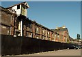
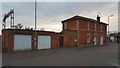
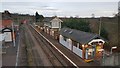
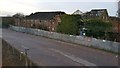
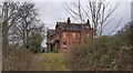
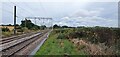
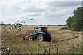
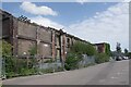
25 photos from this area
Area Information
Key information about the CO16 9PX including its size, population, and administrative classification.
- Area Type
- Postcode
- Area Size
- 50.7 hectares
- Population
- 1706
- Population Density
- 216 people/km²
House Prices in CO16 9PX
21
Properties
£273,333
Average Sold Price
£21,000
Lowest Price
£465,000
Highest Price
Showing 21 properties
| Address | Type | Beds | Baths | Last Sale Price | Last Sale Date | |
|---|---|---|---|---|---|---|
| 269 Harwich Road, Little Clacton, CO16 9PX | Semi-detached | 4 | - | £430,000 | Aug 2025 | |
| 266 Harwich Road, Little Clacton, CO16 9PX | house | 4 | 2 | £465,000 | Jun 2021 | |
| 268 Harwich Road, Little Clacton, CO16 9PX | Bungalow | 2 | - | £315,000 | Feb 2019 | |
| 279 Harwich Road, Little Clacton, CO16 9PX | Semi-detached | 3 | 1 | £325,000 | Feb 2019 | |
| 245 Harwich Road, Little Clacton, CO16 9PX | Semi-detached | 4 | 2 | £260,000 | Dec 2017 | |
| 233 Harwich Road, Little Clacton, CO16 9PX | Semi-detached | - | - | £219,000 | Sep 2007 | |
| 209 Harwich Road, Little Clacton, CO16 9PX | Bungalow | 4 | 2 | £385,000 | Sep 2006 | |
| 273 Harwich Road, Little Clacton, CO16 9PX | house | - | - | £40,000 | May 2000 | |
| 231 Harwich Road, Little Clacton, CO16 9PX | Semi-detached | - | - | £21,000 | Nov 1995 | |
| 239 Harwich Road, Little Clacton, CO16 9PX | Detached | 3 | 2 | - | - |
Page 1 of 3
Energy Efficiency in CO16 9PX
Amenities
Schools
| Rank | School | Type | Entry gender | Ages |
|---|
Explore more schools in this area
Go to Schools tabDemographics
Household Size
Two person
most common
Accommodation Type
Houses
most common
Tenure
90
majority
Ethnic Group
White
most common
Religion
N/A
most common
Household Composition
N/A
most common
Age
47
median
Adults (30-64 years)
most common
Household Deprivation
N/A
with no deprivation
NS-SEC
27
in Lower managerial occupations
Explore more demographic insights in this area
Go to Demographics tabPlanning
Planning Constraints
- Flood RiskPremium
- Ramsar Wetland SitesPremium
- Area of Outstanding Natural BeautyPremium
- Protected Nature ReservePremium
- Protected WoodlandPremium