Area Overview for CO16 9HB
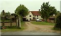
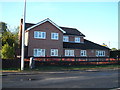
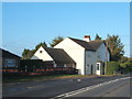
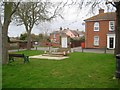
Photos of CO16 9HB

Area Information
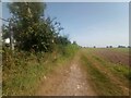
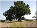
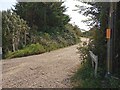
CO16 9HB, a small residential cluster in the Tendring district of Essex, is a village known as Little Clacton. With a population of 1,706 and a density of 216 people per square kilometre, it retains a rural character despite its proximity to Clacton-on-Sea, 2.5 miles to the south. The area’s history dates back to the 11th century, with its name derived from Old English, reflecting its origins as a farmstead. Today, it is a quiet parish with a village green, historic inns, and the 12th-century Parish Church of St James. Daily life here is shaped by its small-scale nature, with residents often walking or cycling to local amenities. The village’s charm lies in its mix of traditional architecture and modern convenience, supported by nearby rail links and a network of local roads. For those seeking a peaceful, community-focused lifestyle, CO16 9HB offers a blend of historical heritage and practical accessibility.
- Area Type
- Postcode
- Area Size
- Not available
- Population
- 1706
- Population Density
- 216 people/km²
The property market in CO16 9HB is dominated by owner-occupied homes, with 90% of residents living in houses rather than flats or rental properties. This reflects a low-density, suburban character typical of small rural parishes. The predominance of houses suggests limited high-rise development, making the area more suited to families seeking space and privacy. Given the area’s small size and low population, the housing stock is likely limited, with properties often being long-term family homes. Buyers should consider the proximity to nearby towns like Clacton-on-Sea for additional amenities, as the immediate area offers fewer commercial or retail options. The high home ownership rate indicates a stable market, but the small size of the postcode means competition for properties could be fierce. Investors may find the area less lucrative due to its niche appeal and limited scalability.
House Prices in CO16 9HB
No properties found in this postcode.
Energy Efficiency in CO16 9HB
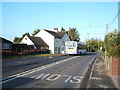
Living in CO16 9HB offers a mix of traditional and modern amenities within practical reach. Retail options include Morrisons Burrsville Park Clacton-on, Lidl Brook Park West, and M&S Clacton, providing essential shopping and dining choices. The village green, featuring a Jubilee Oak and Harold Lilley Playing Field, supports community activities and outdoor recreation. Nearby rail stations at Thorpe-le-Soken and Weeley ensure easy access to larger towns, while ferry landings at Brightlingsea and Point Clear open up coastal routes. The area’s small size means amenities are concentrated, encouraging a walkable lifestyle. Residents can enjoy a quiet, self-contained existence with access to regional hubs for more specialized needs. This balance of convenience and seclusion defines daily life in CO16 9HB.
Amenities
Schools
The nearest school to CO16 9HB is Compass Community School Essex, a special school with a good Ofsted rating. This institution caters to students with specific educational needs, offering tailored support and resources. The presence of a special school suggests the area may attract families with children requiring specialist provisions, though no mainstream schools are listed in the data. For parents seeking a broader range of educational options, nearby towns like Clacton-on-Sea or Colchester would provide more comprehensive school choices. The good Ofsted rating indicates a commitment to quality education, though the single school type means families should assess whether the school’s focus aligns with their child’s requirements.
| Rank | School | Type | Entry gender | Ages |
|---|
Explore more schools in this area
Go to Schools tabDemographics
The population of CO16 9HB is predominantly adults aged 30–64, with a median age of 47. Ninety per cent of residents own their homes, a figure significantly higher than the national average, indicating a stable, long-term community. The accommodation type is primarily houses, reflecting a low-density, suburban layout. The predominant ethnic group is White, though no specific diversity statistics are provided. The age profile suggests a mature demographic, likely with established careers and families. With a population density of 216 people per square kilometre, the area avoids overcrowding, allowing for spacious living. The high home ownership rate and older age range imply a community with strong local ties, where property is often passed through generations. This demographic profile shapes a lifestyle centred on stability, with limited turnover of residents.
Household Size
Accommodation Type
Tenure
Ethnic Group
Religion
Household Composition
Age
Household Deprivation
NS-SEC
Explore more demographic insights in this area
Go to Demographics tabPlanning
Planning Constraints
- Flood RiskPremium
- Ramsar Wetland SitesPremium
- Area of Outstanding Natural BeautyPremium
- Protected Nature ReservePremium
- Protected WoodlandPremium