Area Overview for CO16 8UP
Photos of CO16 8UP
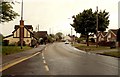
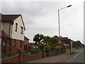
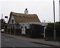
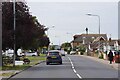
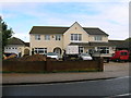

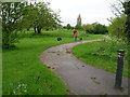
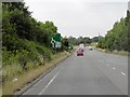
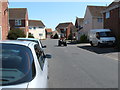


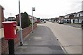
12 photos from this area
Area Information
Key information about the CO16 8UP including its size, population, and administrative classification.
- Area Type
- Postcode
- Area Size
- 5292 m²
- Population
- 1518
- Population Density
- 7090 people/km²
House Prices in CO16 8UP
18
Properties
£117,899
Average Sold Price
£43,000
Lowest Price
£180,000
Highest Price
Showing 18 properties
| Address | Type | Beds | Baths | Last Sale Price | Last Sale Date | |
|---|---|---|---|---|---|---|
| 1 Hudson Close, Clacton On Sea, CO16 8UP | Terraced | 3 | 1 | £180,000 | Jan 2018 | |
| 11 Hudson Close, Clacton On Sea, CO16 8UP | Terraced | 3 | - | £135,000 | Apr 2015 | |
| 23 Hudson Close, Clacton On Sea, CO16 8UP | Terraced | 3 | - | £125,000 | Feb 2014 | |
| 17 Hudson Close, Clacton On Sea, CO16 8UP | house | - | - | £120,000 | May 2013 | |
| 5 Hudson Close, Clacton On Sea, CO16 8UP | Terraced | - | - | £140,000 | Jun 2008 | |
| 2 Hudson Close, Clacton On Sea, CO16 8UP | Terraced | 3 | 1 | £144,000 | Aug 2004 | |
| 19 Hudson Close, Clacton On Sea, CO16 8UP | Terraced | - | - | £129,995 | Nov 2003 | |
| 21 Hudson Close, Clacton On Sea, CO16 8UP | Terraced | - | - | £102,000 | Nov 2002 | |
| 8 Hudson Close, Clacton On Sea, CO16 8UP | house | - | - | £59,995 | Dec 1999 | |
| 7 Hudson Close, Clacton On Sea, CO16 8UP | Terraced | - | - | £43,000 | Feb 1995 |
Page 1 of 2
Energy Efficiency in CO16 8UP
Amenities
Schools
| Rank | School | Type | Entry gender | Ages |
|---|
Explore more schools in this area
Go to Schools tabDemographics
Household Size
Family (3-5 people)
most common
Accommodation Type
Houses
most common
Tenure
66
majority
Ethnic Group
White
most common
Religion
N/A
most common
Household Composition
N/A
most common
Age
47
median
Adults (30-64 years)
most common
Household Deprivation
N/A
with no deprivation
NS-SEC
23
in Lower managerial occupations
Explore more demographic insights in this area
Go to Demographics tabPlanning
Planning Constraints
- Flood RiskPremium
- Ramsar Wetland SitesPremium
- Area of Outstanding Natural BeautyPremium
- Protected Nature ReservePremium
- Protected WoodlandPremium