Area Overview for CO16 8LL
Photos of CO16 8LL

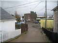
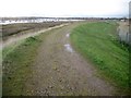
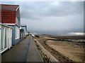
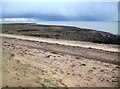
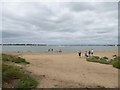
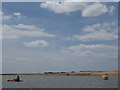
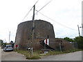
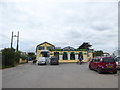
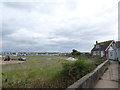
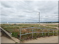
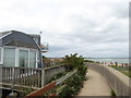
36 photos from this area
Area Information
Key information about the CO16 8LL including its size, population, and administrative classification.
- Area Type
- Postcode
- Area Size
- 24.3 hectares
- Population
- 1707
- Population Density
- 407 people/km²
House Prices in CO16 8LL
58
Properties
£67,986
Average Sold Price
£12,500
Lowest Price
£170,000
Highest Price
Showing 58 properties
| Address | Type | Beds | Baths | Last Sale Price | Last Sale Date | |
|---|---|---|---|---|---|---|
| 33 Colne Way, Point Clear Bay, St Osyth, CO16 8LL | Chalet | 2 | 1 | £117,500 | Dec 2024 | |
| 34 Colne Way, Point Clear Bay, St Osyth, CO16 8LL | Bungalow | 2 | 1 | £155,000 | Aug 2023 | |
| 32 Colne Way, Point Clear Bay, St Osyth, CO16 8LL | Bungalow | 1 | 1 | £170,000 | Jun 2023 | |
| 49 Colne Way, Point Clear Bay, St Osyth, CO16 8LL | Bungalow | - | - | £82,500 | Sep 2022 | |
| 47 Colne Way, Point Clear Bay, St Osyth, CO16 8LL | Bungalow | - | - | £80,000 | Jan 2022 | |
| 42 Colne Way, Point Clear Bay, St Osyth, CO16 8LL | house | 2 | 2 | £90,000 | Nov 2021 | |
| 120 Colne Way, Point Clear Bay, St Osyth, CO16 8LL | Bungalow | 2 | 1 | £85,000 | Nov 2020 | |
| 28 Colne Way, Point Clear Bay, St Osyth, CO16 8LL | Bungalow | 2 | 1 | £97,000 | May 2020 | |
| 51 Colne Way, Point Clear Bay, St Osyth, CO16 8LL | Bungalow | 2 | 1 | £91,000 | Jan 2020 | |
| 31 Colne Way, Point Clear Bay, St Osyth, CO16 8LL | Bungalow | 2 | - | £70,000 | Oct 2019 |
Page 1 of 6
Energy Efficiency in CO16 8LL
Amenities
Schools
| Rank | School | Type | Entry gender | Ages |
|---|
Explore more schools in this area
Go to Schools tabDemographics
Household Size
Two person
most common
Accommodation Type
Houses
most common
Tenure
82
majority
Ethnic Group
White
most common
Religion
N/A
most common
Household Composition
N/A
most common
Age
47
median
Adults (30-64 years)
most common
Household Deprivation
N/A
with no deprivation
NS-SEC
23
in Lower managerial occupations
Explore more demographic insights in this area
Go to Demographics tabPlanning
Planning Constraints
- Flood RiskPremium
- Ramsar Wetland SitesPremium
- Area of Outstanding Natural BeautyPremium
- Protected Nature ReservePremium
- Protected WoodlandPremium