Area Overview for CO16 8BN
Photos of CO16 8BN
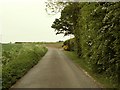
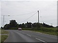
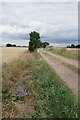
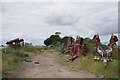
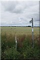
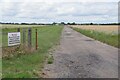
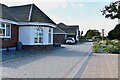
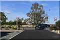
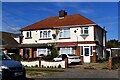
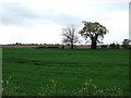
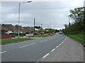
11 photos from this area
Area Information
Key information about the CO16 8BN including its size, population, and administrative classification.
- Area Type
- Postcode
- Area Size
- 17.6 hectares
- Population
- 2798
- Population Density
- 1107 people/km²
House Prices in CO16 8BN
22
Properties
£212,280
Average Sold Price
£45,000
Lowest Price
£365,000
Highest Price
Showing 22 properties
| Address | Type | Beds | Baths | Last Sale Price | Last Sale Date | |
|---|---|---|---|---|---|---|
| 702 St Johns Road, Clacton On Sea, CO16 8BN | Bungalow | 3 | - | £275,000 | Aug 2022 | |
| 760 St Johns Road, Clacton On Sea, CO16 8BN | Bungalow | 4 | 1 | £299,995 | Nov 2019 | |
| 746 St Johns Road, Clacton On Sea, CO16 8BN | Detached | 4 | 2 | £359,000 | Feb 2019 | |
| 740 St Johns Road, Clacton On Sea, CO16 8BN | Bungalow | - | - | £365,000 | Oct 2017 | |
| 708 St Johns Road, Clacton On Sea, CO16 8BN | Bungalow | 3 | 2 | £329,995 | May 2016 | |
| 710 St Johns Road, Clacton On Sea, CO16 8BN | Detached | 3 | 1 | £232,500 | Jul 2015 | |
| 734 St Johns Road, Clacton On Sea, CO16 8BN | Semi-detached | 3 | 1 | £165,000 | Sep 2011 | |
| 704 St Johns Road, Clacton On Sea, CO16 8BN | Bungalow | 4 | 1 | £179,995 | Nov 2005 | |
| 752 St Johns Road, Clacton On Sea, CO16 8BN | Detached | - | - | £187,000 | Oct 2003 | |
| 744 St Johns Road, Clacton On Sea, CO16 8BN | Bungalow | 2 | - | £150,000 | Jun 2003 |
Page 1 of 3
Energy Efficiency in CO16 8BN
Amenities
Schools
| Rank | School | Type | Entry gender | Ages |
|---|
Explore more schools in this area
Go to Schools tabDemographics
Household Size
Two person
most common
Accommodation Type
Houses
most common
Tenure
73
majority
Ethnic Group
White
most common
Religion
N/A
most common
Household Composition
N/A
most common
Age
47
median
Adults (30-64 years)
most common
Household Deprivation
N/A
with no deprivation
NS-SEC
20
in Lower managerial occupations
Explore more demographic insights in this area
Go to Demographics tabPlanning
Planning Constraints
- Flood RiskPremium
- Ramsar Wetland SitesPremium
- Area of Outstanding Natural BeautyPremium
- Protected Nature ReservePremium
- Protected WoodlandPremium