Area Overview for CO16 8BE
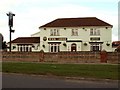
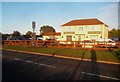
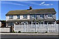
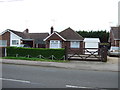
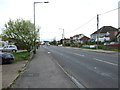
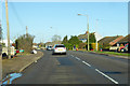
Photos of CO16 8BE

Area Information
Living in CO16 8BE means residing within Bluehouse Ward, a distinct residential cluster in Clacton-on-Sea, Essex. This specific postcode covers an area of 11.4 hectares, creating a relatively dense environment for its inhabitants. The total population stands at 1,353 people, resulting in a population density of 11,907 people per square kilometre. This high figure indicates tightly packed housing compared to broader district averages. The location forms part of the Clacton parliamentary constituency and falls under the jurisdiction of Tendring District Council. Coordination details place the ward at coordinates 51.798213, 1.130103. Residential streets such as Hampstead Avenue, Parry Drive, and Constable Avenue define the local landscape. Daily life is centred around immediate neighbours rather than sprawling suburbs. The community is compact, meaning residents are often aware of local events and changes within their specific neighbourhood. Buying a home here grants access to a established residential zone without the isolation of extreme density. It is a contained environment where the boundaries of your immediate neighbourhood are clearly defined by local street names and ward lines.
- Area Type
- Postcode
- Area Size
- 11.4 hectares
- Population
- 1353
- Population Density
- 2867 people/km²
The property market in CO16 8BE presents a specific profile for buyers. Every recorded property in this postcode is a house. There are no flats or other dwelling types listed for this specific cluster. Home ownership stands at 34% of the total housing stock. This means that approximately two-thirds of these houses are rented properties. Such a low ownership rate suggests a market where investors or private landlords hold significant control over the local housing supply. For a prospective buyer looking for a house here, the competition may involve competing against established owners with long-term roots in the ward. The small area size of 11.4 hectares limits the total number of available properties significantly. You might find that inventory changes slowly as owners are frugal about selling. The high population density of 11,907 people per square kilometre implies that demand for existing homes remains consistent despite the limited supply. Buyers should view this area as a niche market with a clear distinction between the existing owner-occupied segment and the larger rental segment.
House Prices in CO16 8BE
Showing 2 properties
| Address | Type | Beds | Baths | Last Sale Price | Last Sale Date | |
|---|---|---|---|---|---|---|
| The Bungalow, Clacton Coastal Academy, Jaywick Lane, Clacton On Sea, CO16 8BE | Detached | - | - | - | - | |
| Tendring Eldercare, Day Centre At, Tendring Education Centre, Jaywick Lane, Clacton On Sea, CO16 8BE | commercial | - | - | - | - |
Energy Efficiency in CO16 8BE
Daily life in CO16 8BE benefits from a cluster of nearby amenities within practical reach for residents. Your shopping needs are met by five local retail outlets. Notable venues include Morrisons Daily, East of England Co-operative Co, and Spar. These shops are situated close to the residential streets like Parry Drive and Gilders Way. For travel, five railway stations are conveniently located near your doorstep. Clacton, Weeley Railway Station, and Thorpe are the key hubs for train access. If you prefer coastal travel, three ferry landing points are accessible. Brightlingsea Ferry Landing, Point Clear Ferry Landing, and East Mersea Ferry Landing connect you to nearby coastal towns. This variety of transport options reduces reliance on cars for certain journeys. Residents can shop for groceries, coffee, and essentials at the Spar or the Co-operative Co. The proximity of these services means you do not need to travel far for daily necessities. The layout supports a lifestyle where local amenities play a central role in your routine.
Amenities
Schools
Families considering CO16 8BE have access to several educational institutions within close proximity. St Clare's Catholic Primary School operates within the immediate vicinity and holds a Good Ofsted rating. This school offers a solid educational foundation for younger children. Nearby, Bishops Park College also functions as a primary school option for the local community. For older students, the area connects to Tendring Enterprise Studio School. This institution serves the secondary education needs of children growing up in the ward. The presence of multiple primary options alongside one secondary school provides a straightforward route for family planning. You do not need to look far for schooling needs to be met. The Good rating at St Clare's Catholic Primary School offers reassurance regarding the quality of early education. The mix of private and public types, indicated by the Catholic primary and Enterprise Studio designation, offers different educational philosophies. Residents can choose between St Clare's, Bishops Park, and the secondary option depending on their family's educational requirements.
| Rank | School | Type | Entry gender | Ages |
|---|
Explore more schools in this area
Go to Schools tabDemographics
The community in CO16 8BE is defined by an older demographic profile. The median age is 47 years, which positions the area as particularly popular with middle-aged adults. The most common age range for residents falls between 30 and 64 years. This suggests a population currently comfortable in their careers and likely focused on stability rather than young families or retirees. Home ownership stands at a relatively modest 34% of households. The remaining 66% of residents are likely renting, indicating a significant proportion of the community may be tenants rather than owner-occupiers. All accommodation in this postcode cluster consists of houses. There are no flats, bungalows, or other varied housing styles within this specific data set. The predominant ethnic group is White, reflecting the traditional character of the Bluehouse Ward. Safety is a notable concern; crime risk assessment scores a critical level with a score of 1 out of 100. This places the area in a high-risk bracket compared to national standards. Residents should understand that enhanced security measures are advisable due to elevated crime rates relative to other locations.
Household Size
Accommodation Type
Tenure
Ethnic Group
Religion
Household Composition
Age
Household Deprivation
NS-SEC
Explore more demographic insights in this area
Go to Demographics tabPlanning
Planning Constraints
- Flood RiskPremium
- Ramsar Wetland SitesPremium
- Area of Outstanding Natural BeautyPremium
- Protected Nature ReservePremium
- Protected WoodlandPremium