Area Overview for CO16 8AD
Photos of CO16 8AD
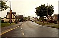
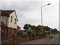
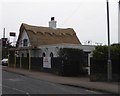
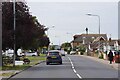
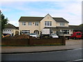
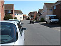

12 photos from this area
Area Information
Key information about the CO16 8AD including its size, population, and administrative classification.
- Area Type
- Postcode
- Area Size
- 4301 m²
- Population
- 1546
- Population Density
- 3853 people/km²
House Prices in CO16 8AD
12
Properties
£219,399
Average Sold Price
£94,500
Lowest Price
£364,500
Highest Price
Showing 12 properties
| Address | Type | Beds | Baths | Last Sale Price | Last Sale Date | |
|---|---|---|---|---|---|---|
| 10 Minsmere Drive, Clacton On Sea, CO16 8AD | Detached | 4 | 2 | £355,000 | Nov 2024 | |
| 8 Minsmere Drive, Clacton On Sea, CO16 8AD | house | - | - | £364,500 | Mar 2019 | |
| 3 Minsmere Drive, Clacton On Sea, CO16 8AD | house | - | - | £230,000 | Mar 2019 | |
| 16 Minsmere Drive, Clacton On Sea, CO16 8AD | house | - | - | £319,995 | Nov 2015 | |
| 12 Minsmere Drive, Clacton On Sea, CO16 8AD | Detached | 4 | 2 | £246,995 | Feb 2015 | |
| 1 Minsmere Drive, Clacton On Sea, CO16 8AD | Detached | 4 | 2 | £217,500 | Nov 2005 | |
| 4 Minsmere Drive, Clacton On Sea, CO16 8AD | Detached | - | - | £155,000 | May 2002 | |
| 14 Minsmere Drive, Clacton On Sea, CO16 8AD | Detached | - | - | £94,500 | Jul 2000 | |
| 6 Minsmere Drive, Clacton On Sea, CO16 8AD | Detached | - | - | £115,000 | Sep 1999 | |
| 5 Minsmere Drive, Clacton On Sea, CO16 8AD | Detached | - | - | £95,500 | Sep 1998 |
Page 1 of 2
Energy Efficiency in CO16 8AD
Amenities
Schools
| Rank | School | Type | Entry gender | Ages |
|---|
Explore more schools in this area
Go to Schools tabDemographics
Household Size
Two person
most common
Accommodation Type
Houses
most common
Tenure
83
majority
Ethnic Group
White
most common
Religion
N/A
most common
Household Composition
N/A
most common
Age
47
median
Adults (30-64 years)
most common
Household Deprivation
N/A
with no deprivation
NS-SEC
25
in Lower managerial occupations
Explore more demographic insights in this area
Go to Demographics tabPlanning
Planning Constraints
- Flood RiskPremium
- Ramsar Wetland SitesPremium
- Area of Outstanding Natural BeautyPremium
- Protected Nature ReservePremium
- Protected WoodlandPremium