Area Overview for CO16 7HP
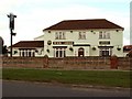
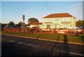
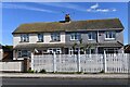
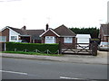
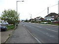
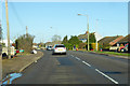
Photos of CO16 7HP


Area Information
Living in CO16 7HP means being part of a small, tightly knit residential cluster in England. With a population of just 1,353, the area feels intimate, where daily life is shaped by proximity to essential services and natural surroundings. The postcode covers a compact mix of homes, many of which are owner-occupied, reflecting a community rooted in long-term residency. Residents benefit from nearby schools, including St Clare’s Catholic Primary School and Bishops Park College, both of which cater to younger families. The area’s proximity to rail networks, such as Clacton and Thorpe stations, and ferry services like Brightlingsea Ferry Landing, adds to its connectivity. While the population is relatively small, the area’s blend of residential tranquillity and practical amenities makes it appealing for those seeking a balanced lifestyle without the pressures of larger urban centres.
- Area Type
- Postcode
- Area Size
- Not available
- Population
- 1353
- Population Density
- 2867 people/km²
CO16 7HP is characterised by a housing stock that leans heavily on owner-occupied properties, with 34% of homes owned by residents. The accommodation type is predominantly houses, which is unusual for areas with higher rental markets. This suggests a community where long-term residency is common, and properties are likely to be family homes rather than flats or apartments. The small population and focus on houses mean the area is not a high-demand rental hub, but rather a place where buyers may find more spacious, traditional homes. For those considering the area, the limited number of properties means competition could be lower, but the need for a home to suit a family-oriented lifestyle is evident.
House Prices in CO16 7HP
No properties found in this postcode.
Energy Efficiency in CO16 7HP
The area’s lifestyle is shaped by its proximity to retail, transport, and leisure options. Nearby shops include Sainsburys Clacton St, Tesco Clacton, and the East of England Co-operative Co, offering a range of everyday essentials. Rail stations and ferry landings provide easy access to commuting and travel, while the surrounding environment likely includes parks and open spaces, though specific names are not listed. The combination of local shopping, transport links, and natural access points creates a convenient, low-stress daily routine for residents.
Amenities
Schools
Nearby schools include St Clare’s Catholic Primary School, which has an Ofsted rating of ‘good’, and Bishops Park College, another primary school. For secondary education, Tendring Enterprise Studio School serves the area. The mix of primary and secondary options provides a continuum of education for families. The presence of two primary schools within the postcode suggests a strong local focus on early education, while the secondary school offers a broader curriculum. These institutions cater to a range of learning needs, though the limited number of schools may require students to travel slightly further for higher education.
| Rank | School | Type | Entry gender | Ages |
|---|
Explore more schools in this area
Go to Schools tabDemographics
The median age in CO16 7HP is 47, with the most common age group being adults aged 30–64. This suggests a community of established residents, many of whom are likely to be homeowners. Home ownership stands at 34%, indicating that nearly a third of properties are owner-occupied, while the rest are likely rented. The predominant ethnic group is White, and the accommodation type is primarily houses, reflecting a more traditional, family-oriented housing stock. There is no specific data on deprivation levels, but the age profile and ownership figures imply a stable, mature population with fewer transient residents. For buyers, this demographic suggests a community with a focus on long-term living rather than short-term rental turnover.
Household Size
Accommodation Type
Tenure
Ethnic Group
Religion
Household Composition
Age
Household Deprivation
NS-SEC
Explore more demographic insights in this area
Go to Demographics tabPlanning
Planning Constraints
- Flood RiskPremium
- Ramsar Wetland SitesPremium
- Area of Outstanding Natural BeautyPremium
- Protected Nature ReservePremium
- Protected WoodlandPremium