Area Overview for CO16 7BT
Photos of CO16 7BT
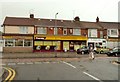
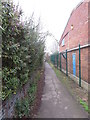
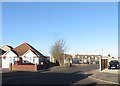
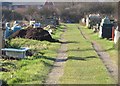
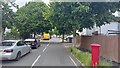
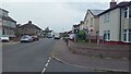
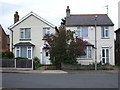
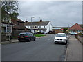
19 photos from this area
Area Information
Key information about the CO16 7BT including its size, population, and administrative classification.
- Area Type
- Postcode
- Area Size
- 8751 m²
- Population
- 1461
- Population Density
- 5951 people/km²
House Prices in CO16 7BT
26
Properties
£163,958
Average Sold Price
£55,000
Lowest Price
£290,000
Highest Price
Showing 26 properties
| Address | Type | Beds | Baths | Last Sale Price | Last Sale Date | |
|---|---|---|---|---|---|---|
| 9 Ruaton Drive, Clacton On Sea, CO16 7BT | Terraced | 3 | 1 | £227,500 | Oct 2024 | |
| 2 Ruaton Drive, Clacton On Sea, CO16 7BT | Detached | 3 | 1 | £290,000 | Jan 2023 | |
| 4 Ruaton Drive, Clacton On Sea, CO16 7BT | Detached | 3 | 1 | £280,000 | Jan 2023 | |
| 17 Ruaton Drive, Clacton On Sea, CO16 7BT | Terraced | 2 | 1 | £215,000 | Oct 2022 | |
| 6 Ruaton Drive, Clacton On Sea, CO16 7BT | house | - | - | £227,000 | Apr 2021 | |
| 19 Ruaton Drive, Clacton On Sea, CO16 7BT | Terraced | 2 | 1 | £119,000 | Aug 2014 | |
| 15 Ruaton Drive, Clacton On Sea, CO16 7BT | house | 3 | 1 | £116,000 | Mar 2012 | |
| 1A Ruaton Drive, Clacton On Sea, CO16 7BT | Detached | 3 | 1 | £166,000 | Jul 2007 | |
| 11 Ruaton Drive, Clacton On Sea, CO16 7BT | Terraced | - | - | £127,000 | Apr 2004 | |
| 3 Ruaton Drive, Clacton On Sea, CO16 7BT | house | - | - | £70,000 | Jun 2003 |
Page 1 of 3
Energy Efficiency in CO16 7BT
Amenities
Schools
| Rank | School | Type | Entry gender | Ages |
|---|
Explore more schools in this area
Go to Schools tabDemographics
Household Size
Two person
most common
Accommodation Type
Houses
most common
Tenure
67
majority
Ethnic Group
White
most common
Religion
N/A
most common
Household Composition
N/A
most common
Age
47
median
Adults (30-64 years)
most common
Household Deprivation
N/A
with no deprivation
NS-SEC
20
in Lower managerial occupations
Explore more demographic insights in this area
Go to Demographics tabPlanning
Planning Constraints
- Flood RiskPremium
- Ramsar Wetland SitesPremium
- Area of Outstanding Natural BeautyPremium
- Protected Nature ReservePremium
- Protected WoodlandPremium