Area Overview for CO16 0LP
Photos of CO16 0LP

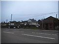
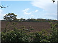
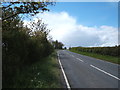

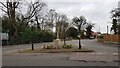
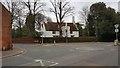
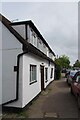
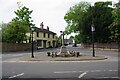

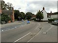

12 photos from this area
Area Information
Key information about the CO16 0LP including its size, population, and administrative classification.
- Area Type
- Postcode
- Area Size
- 1.4 hectares
- Population
- 1272
- Population Density
- 270 people/km²
House Prices in CO16 0LP
19
Properties
£314,373
Average Sold Price
£105,000
Lowest Price
£488,500
Highest Price
Showing 19 properties
| Address | Type | Beds | Baths | Last Sale Price | Last Sale Date | |
|---|---|---|---|---|---|---|
| Thorpden, New Thorpe Avenue, Thorpe Le Soken, CO16 0LP | Detached | 5 | 2 | £330,000 | Dec 2024 | |
| Rivendell, New Thorpe Avenue, Thorpe Le Soken, CO16 0LP | Detached | 5 | 2 | £447,435 | Sep 2022 | |
| Juba Leas, New Thorpe Avenue, Thorpe Le Soken, CO16 0LP | house | - | - | £440,000 | Mar 2021 | |
| Landermere, New Thorpe Avenue, Thorpe Le Soken, CO16 0LP | house | - | - | £422,000 | Feb 2019 | |
| The Croft, New Thorpe Avenue, Thorpe Le Soken, CO16 0LP | Detached | 4 | 3 | £488,500 | Aug 2018 | |
| Poplar House, New Thorpe Avenue, Thorpe Le Soken, CO16 0LP | Detached | 3 | - | £278,500 | Jun 2015 | |
| Balquhidder, New Thorpe Avenue, Thorpe Le Soken, CO16 0LP | Detached | 3 | 2 | £410,000 | Nov 2014 | |
| Tall Trees, New Thorpe Avenue, Thorpe Le Soken, CO16 0LP | house | 3 | - | £194,292 | Sep 2011 | |
| Timbers, New Thorpe Avenue, Thorpe Le Soken, CO16 0LP | Detached | - | - | £282,500 | Apr 2008 | |
| The Laurels, New Thorpe Avenue, Thorpe Le Soken, CO16 0LP | Detached | - | - | £400,000 | Aug 2007 |
Page 1 of 2
Energy Efficiency in CO16 0LP
Amenities
Schools
| Rank | School | Type | Entry gender | Ages |
|---|
Explore more schools in this area
Go to Schools tabDemographics
Household Size
Two person
most common
Accommodation Type
Houses
most common
Tenure
94
majority
Ethnic Group
White
most common
Religion
N/A
most common
Household Composition
N/A
most common
Age
47
median
Adults (30-64 years)
most common
Household Deprivation
N/A
with no deprivation
NS-SEC
37
in Lower managerial occupations
Explore more demographic insights in this area
Go to Demographics tabPlanning
Planning Constraints
- Flood RiskPremium
- Ramsar Wetland SitesPremium
- Area of Outstanding Natural BeautyPremium
- Protected Nature ReservePremium
- Protected WoodlandPremium