Area Overview for CO16 0ES
Photos of CO16 0ES
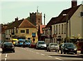
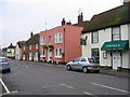

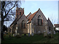
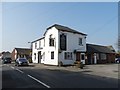

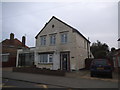
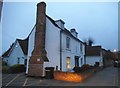
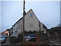
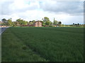
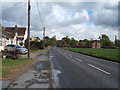
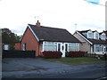
33 photos from this area
Area Information
Key information about the CO16 0ES including its size, population, and administrative classification.
- Area Type
- Postcode
- Area Size
- 2.0 hectares
- Population
- 1272
- Population Density
- 270 people/km²
House Prices in CO16 0ES
15
Properties
£294,333
Average Sold Price
£49,000
Lowest Price
£620,000
Highest Price
Showing 15 properties
| Address | Type | Beds | Baths | Last Sale Price | Last Sale Date | |
|---|---|---|---|---|---|---|
| Advena, Argyle Road, Thorpe Le Soken, CO16 0ES | Bungalow | 3 | 2 | £412,000 | Dec 2023 | |
| Whampoa, Argyle Road, Thorpe Le Soken, CO16 0ES | Detached | 5 | 3 | £620,000 | Oct 2023 | |
| Sundial, Argyle Road, Thorpe Le Soken, CO16 0ES | Bungalow | 2 | 1 | £369,000 | Jun 2023 | |
| Gilder, Argyle Road, Thorpe Le Soken, CO16 0ES | Bungalow | - | - | £374,000 | Nov 2022 | |
| Russet, Argyle Road, Thorpe Le Soken, CO16 0ES | Detached | 3 | 2 | £430,000 | Mar 2018 | |
| Lynton, Argyle Road, Thorpe Le Soken, CO16 0ES | Bungalow | 2 | - | £215,000 | May 2014 | |
| The Maple, Argyle Road, Thorpe Le Soken, CO16 0ES | Bungalow | 2 | 1 | £186,000 | Sep 2013 | |
| Copt Oak, Argyle Road, Thorpe Le Soken, CO16 0ES | Bungalow | 3 | - | £295,000 | Nov 2010 | |
| The Nook, Argyle Road, Thorpe Le Soken, CO16 0ES | Bungalow | 4 | 2 | £249,999 | May 2004 | |
| Dunalastair, Argyle Road, Thorpe Le Soken, CO16 0ES | Detached | - | - | £166,000 | Dec 1999 |
Page 1 of 2
Energy Efficiency in CO16 0ES
Amenities
Schools
| Rank | School | Type | Entry gender | Ages |
|---|
Explore more schools in this area
Go to Schools tabDemographics
Household Size
Two person
most common
Accommodation Type
Houses
most common
Tenure
94
majority
Ethnic Group
White
most common
Religion
N/A
most common
Household Composition
N/A
most common
Age
47
median
Adults (30-64 years)
most common
Household Deprivation
N/A
with no deprivation
NS-SEC
37
in Lower managerial occupations
Explore more demographic insights in this area
Go to Demographics tabPlanning
Planning Constraints
- Flood RiskPremium
- Ramsar Wetland SitesPremium
- Area of Outstanding Natural BeautyPremium
- Protected Nature ReservePremium
- Protected WoodlandPremium