Area Overview for CO16 0BE
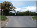
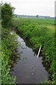
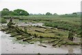
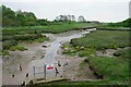
Photos of CO16 0BE


Area Information
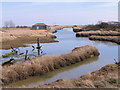
Living in CO16 0BE, a small residential cluster in Essex, offers a quiet, low-density lifestyle with a population of 1,342 spread across 50 people per square kilometre. Situated in the civil parish of Beaumont-cum-Moze, the area blends historical significance with modern convenience. The name derives from Old English, reflecting its medieval roots as a marshy landscape with agricultural and maritime ties. Today, the parish retains echoes of its past, including the 11th-century Parish Church of St Leonard and St Mary, which has undergone extensive restoration. Residents benefit from proximity to Beaumont Quay, a 19th-century navigation project, and the derelict Beaumont Cut canal, offering a unique blend of heritage and tranquillity. Daily life here is characterised by a close-knit community, with easy access to nearby rail stations and local shops. The area’s small size means a strong sense of familiarity, though its limited scale may appeal more to those seeking a peaceful, low-traffic environment than a bustling urban centre.
- Area Type
- Postcode
- Area Size
- Not available
- Population
- 1342
- Population Density
- 50 people/km²
The property market in CO16 0BE is dominated by owner-occupied homes, with 71% of residents owning their properties. This high rate of home ownership suggests a stable, long-term community with limited rental activity, which is typical of smaller, low-density areas. The accommodation type is primarily houses, reflecting the area’s rural and semi-rural setting. This contrasts with urban centres where flats or apartments are more common. For buyers, this means a market focused on individual homes rather than shared spaces, though the small size of the postcode area may limit the availability of new builds or developments. The emphasis on houses also implies that properties here are likely larger and more suited to families or those seeking space. However, the limited number of homes in the area means competition could be fierce for available properties, particularly for those prioritising proximity to local amenities like schools and transport links.
House Prices in CO16 0BE
No properties found in this postcode.
Energy Efficiency in CO16 0BE
The lifestyle in CO16 0BE is shaped by its proximity to essential amenities and historical landmarks. Within practical reach are five retail outlets, including multiple Tesco stores, ensuring easy access to groceries and daily necessities. The area’s rail network, with five nearby stations, facilitates travel to nearby towns and cities, while the low population density fosters a relaxed pace of life. Residents can explore the Parish Church of St Leonard and St Mary, a semi-modernised 11th-century building, or visit Beaumont Quay, a 19th-century quayside with historical significance. Though the data does not mention parks or leisure facilities, the area’s small size and low density suggest a focus on quiet, residential living rather than large-scale recreation. The blend of heritage sites and practical amenities creates a characterful environment, appealing to those who value history and convenience in equal measure.
Amenities
Schools
Residents of CO16 0BE have access to two primary schools within the area: Rolph CofE Primary School and Rolph Church of England Primary School and Nursery, the latter of which holds an Ofsted rating of ‘good’. Both institutions serve the local community, offering early years education and primary schooling. The presence of two schools, even within a small postcode area, suggests a focus on education for younger families. The ‘good’ rating at Rolph Church of England Primary School indicates a satisfactory standard of teaching and facilities, which is reassuring for parents seeking quality education for their children. However, the absence of secondary schools or further education institutions in the immediate vicinity means families may need to look beyond CO16 0BE for comprehensive schooling. This could be a consideration for those prioritising a fully integrated educational environment within the area.
| Rank | School | Type | Entry gender | Ages |
|---|
Explore more schools in this area
Go to Schools tabDemographics
The population of CO16 0BE has a median age of 47, with the majority of residents aged 30–64 years. This suggests a community skewed towards middle-aged and older adults, likely reflecting long-term residency and lower turnover. Home ownership is high at 71%, indicating a stable, settled population with a preference for owning property rather than renting. The predominant accommodation type is houses, which aligns with the area’s low density and rural character. The predominant ethnic group is White, with no specific data provided on other demographics. This age profile and ownership rate imply a community with established families and professionals, though the absence of detailed diversity metrics means the full range of cultural or generational diversity remains unclear. The relatively high median age may also suggest a lower demand for schools catering to younger children, though this is offset by the presence of two primary schools nearby.
Household Size
Accommodation Type
Tenure
Ethnic Group
Religion
Household Composition
Age
Household Deprivation
NS-SEC
Explore more demographic insights in this area
Go to Demographics tabPlanning
Planning Constraints
- Flood RiskPremium
- Ramsar Wetland SitesPremium
- Area of Outstanding Natural BeautyPremium
- Protected Nature ReservePremium
- Protected WoodlandPremium