Area Overview for CO15 6PT
Photos of CO15 6PT
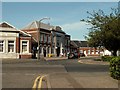

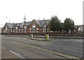
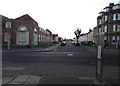
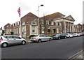
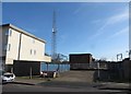
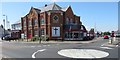
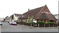
56 photos from this area
Area Information
Key information about the CO15 6PT including its size, population, and administrative classification.
- Area Type
- Postcode
- Area Size
- 1.7 hectares
- Population
- Not available
- Population Density
- Not available
House Prices in CO15 6PT
60
Properties
£205,973
Average Sold Price
£47,000
Lowest Price
£360,000
Highest Price
Showing 60 properties
| Address | Type | Beds | Baths | Last Sale Price | Last Sale Date | |
|---|---|---|---|---|---|---|
| 12 Chapman Road, Clacton On Sea, CO15 6PT | house | - | - | £342,000 | Nov 2025 | |
| 37A Chapman Road, Clacton On Sea, CO15 6PT | Maisonette | 1 | 1 | £124,000 | Mar 2023 | |
| 6 Chapman Road, Clacton On Sea, CO15 6PT | house | - | - | £219,000 | Aug 2022 | |
| 26 Chapman Road, Clacton On Sea, CO15 6PT | Retail | 3 | 1 | £295,000 | Jun 2022 | |
| 32 Chapman Road, Clacton On Sea, CO15 6PT | Detached | 4 | 2 | £360,000 | Mar 2021 | |
| 5A Chapman Road, Clacton On Sea, CO15 6PT | Flat | 5 | - | £125,000 | Jan 2021 | |
| 5 Chapman Road, Clacton On Sea, CO15 6PT | Flat | 2 | 1 | £146,500 | Dec 2020 | |
| 10 Chapman Road, Clacton On Sea, CO15 6PT | Detached | 3 | 1 | £337,500 | Oct 2020 | |
| 7 Chapman Road, Clacton On Sea, CO15 6PT | Semi-detached | 5 | 1 | £249,995 | Oct 2020 | |
| 20 Chapman Road, Clacton On Sea, CO15 6PT | Bungalow | 2 | 1 | £232,500 | Sep 2020 |
Page 1 of 6
Energy Efficiency in CO15 6PT
Amenities
Schools
| Rank | School | Type | Entry gender | Ages |
|---|
Explore more schools in this area
Go to Schools tabDemographics
Household Size
One person
most common
Accommodation Type
Flats
most common
Tenure
51
majority
Ethnic Group
White
most common
Religion
N/A
most common
Household Composition
N/A
most common
Age
47
median
Adults (30-64 years)
most common
Household Deprivation
N/A
with no deprivation
NS-SEC
24
in Lower managerial occupations
Explore more demographic insights in this area
Go to Demographics tabPlanning
Planning Constraints
- Flood RiskPremium
- Ramsar Wetland SitesPremium
- Area of Outstanding Natural BeautyPremium
- Protected Nature ReservePremium
- Protected WoodlandPremium