Area Overview for CO15 5RD
Photos of CO15 5RD

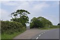
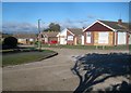
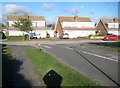

5 photos from this area
Area Information
Key information about the CO15 5RD including its size, population, and administrative classification.
- Area Type
- Postcode
- Area Size
- 9.7 hectares
- Population
- 2121
- Population Density
- 1410 people/km²
House Prices in CO15 5RD
10
Properties
£135,562
Average Sold Price
£50,000
Lowest Price
£245,000
Highest Price
Showing 10 properties
| Address | Type | Beds | Baths | Last Sale Price | Last Sale Date | |
|---|---|---|---|---|---|---|
| 107 Aylesbury Drive, Holland On Sea, CO15 5RD | Bungalow | 2 | 1 | £245,000 | Jun 2024 | |
| 105 Aylesbury Drive, Holland On Sea, CO15 5RD | Semi-detached | 2 | 1 | £218,000 | Nov 2023 | |
| 91 Aylesbury Drive, Holland On Sea, CO15 5RD | Detached | - | - | £110,000 | May 2018 | |
| 95 Aylesbury Drive, Holland On Sea, CO15 5RD | Bungalow | - | - | £127,500 | Oct 2013 | |
| 109 Aylesbury Drive, Holland On Sea, CO15 5RD | Bungalow | - | - | £146,000 | Apr 2005 | |
| 93 Aylesbury Drive, Holland On Sea, CO15 5RD | Detached | - | - | £109,995 | Apr 2002 | |
| 103 Aylesbury Drive, Holland On Sea, CO15 5RD | Detached | - | - | £78,000 | Jun 2001 | |
| 101 Aylesbury Drive, Holland On Sea, CO15 5RD | Detached | - | - | £50,000 | Jul 1998 | |
| 97 Aylesbury Drive, Holland On Sea, CO15 5RD | Bungalow | - | - | - | - | |
| 99 Aylesbury Drive, Holland On Sea, CO15 5RD | Detached | - | - | - | - |
Energy Efficiency in CO15 5RD
Amenities
Schools
| Rank | School | Type | Entry gender | Ages |
|---|
Explore more schools in this area
Go to Schools tabDemographics
Household Size
Two person
most common
Accommodation Type
Houses
most common
Tenure
86
majority
Ethnic Group
White
most common
Religion
N/A
most common
Household Composition
N/A
most common
Age
47
median
Elderly (65+ years)
most common
Household Deprivation
N/A
with no deprivation
NS-SEC
26
in Lower managerial occupations
Explore more demographic insights in this area
Go to Demographics tabPlanning
Planning Constraints
- Flood RiskPremium
- Ramsar Wetland SitesPremium
- Area of Outstanding Natural BeautyPremium
- Protected Nature ReservePremium
- Protected WoodlandPremium