Area Overview for CO15 5QL
Photos of CO15 5QL
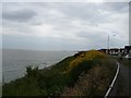
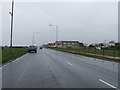

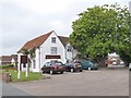
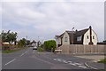
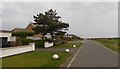
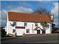
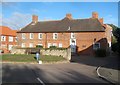
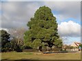
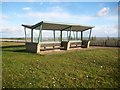
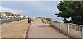
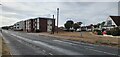
30 photos from this area
Area Information
Key information about the CO15 5QL including its size, population, and administrative classification.
- Area Type
- Postcode
- Area Size
- 1.3 hectares
- Population
- 2121
- Population Density
- 1410 people/km²
House Prices in CO15 5QL
24
Properties
£255,722
Average Sold Price
£68,000
Lowest Price
£525,000
Highest Price
Showing 24 properties
| Address | Type | Beds | Baths | Last Sale Price | Last Sale Date | |
|---|---|---|---|---|---|---|
| 60 Canterbury Road, Holland On Sea, CO15 5QL | house | - | - | £525,000 | Feb 2023 | |
| 54 Canterbury Road, Holland On Sea, CO15 5QL | Detached | 3 | 2 | £500,000 | Nov 2022 | |
| 31 Canterbury Road, Holland On Sea, CO15 5QL | Bungalow | 2 | 1 | £335,000 | Jul 2022 | |
| 45 Canterbury Road, Holland On Sea, CO15 5QL | Bungalow | - | - | £273,000 | Mar 2021 | |
| 35 Canterbury Road, Holland On Sea, CO15 5QL | Bungalow | - | - | £250,000 | Jan 2021 | |
| 37 Canterbury Road, Holland On Sea, CO15 5QL | Bungalow | 3 | 1 | £274,000 | May 2018 | |
| 38 Canterbury Road, Holland On Sea, CO15 5QL | Detached | 3 | 1 | £284,000 | Nov 2016 | |
| 47 Canterbury Road, Holland On Sea, CO15 5QL | Bungalow | - | - | £288,000 | Oct 2016 | |
| 50 Canterbury Road, Holland On Sea, CO15 5QL | house | - | - | £259,995 | Nov 2015 | |
| 43 Canterbury Road, Holland On Sea, CO15 5QL | Bungalow | 2 | - | £240,000 | Jan 2015 |
Page 1 of 3
Energy Efficiency in CO15 5QL
Amenities
Schools
| Rank | School | Type | Entry gender | Ages |
|---|
Explore more schools in this area
Go to Schools tabDemographics
Household Size
Two person
most common
Accommodation Type
Houses
most common
Tenure
86
majority
Ethnic Group
White
most common
Religion
N/A
most common
Household Composition
N/A
most common
Age
47
median
Elderly (65+ years)
most common
Household Deprivation
N/A
with no deprivation
NS-SEC
26
in Lower managerial occupations
Explore more demographic insights in this area
Go to Demographics tabPlanning
Planning Constraints
- Flood RiskPremium
- Ramsar Wetland SitesPremium
- Area of Outstanding Natural BeautyPremium
- Protected Nature ReservePremium
- Protected WoodlandPremium