Area Overview for CO15 2AP
Photos of CO15 2AP
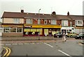
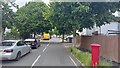
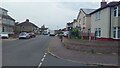
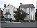
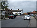
19 photos from this area
Area Information
Key information about the CO15 2AP including its size, population, and administrative classification.
- Area Type
- Postcode
- Area Size
- 2858 m²
- Population
- 1482
- Population Density
- 6691 people/km²
House Prices in CO15 2AP
10
Properties
£118,714
Average Sold Price
£22,000
Lowest Price
£236,000
Highest Price
Showing 10 properties
| Address | Type | Beds | Baths | Last Sale Price | Last Sale Date | |
|---|---|---|---|---|---|---|
| 91 Jameson Road, Clacton On Sea, CO15 2AP | Retail | 3 | 1 | £236,000 | Jun 2022 | |
| 89 Jameson Road, Clacton On Sea, CO15 2AP | Semi-detached | - | - | £170,000 | Oct 2016 | |
| 79 Jameson Road, Clacton On Sea, CO15 2AP | house | - | - | £155,000 | Jul 2016 | |
| Arboria, 83 Jameson Road, Clacton On Sea, CO15 2AP | Semi-detached | 3 | - | £149,995 | Dec 2005 | |
| 81 Jameson Road, Clacton On Sea, CO15 2AP | house | - | - | £45,000 | Aug 1999 | |
| 95 Jameson Road, Clacton On Sea, CO15 2AP | house | - | - | £53,000 | Jul 1999 | |
| 87 Jameson Road, Clacton On Sea, CO15 2AP | house | - | - | £22,000 | Jul 1995 | |
| 85 Jameson Road, Clacton On Sea, CO15 2AP | Detached | 3 | 1 | - | - | |
| 93 Jameson Road, Clacton On Sea, CO15 2AP | Semi-detached | - | - | - | - | |
| 97 Jameson Road, Clacton On Sea, CO15 2AP | Semi-detached | - | - | - | - |
Energy Efficiency in CO15 2AP
Amenities
Schools
| Rank | School | Type | Entry gender | Ages |
|---|
Explore more schools in this area
Go to Schools tabDemographics
Household Size
Family (3-5 people)
most common
Accommodation Type
Houses
most common
Tenure
64
majority
Ethnic Group
White
most common
Religion
N/A
most common
Household Composition
N/A
most common
Age
47
median
Adults (30-64 years)
most common
Household Deprivation
N/A
with no deprivation
NS-SEC
18
in Lower managerial occupations
Explore more demographic insights in this area
Go to Demographics tabPlanning
Planning Constraints
- Flood RiskPremium
- Ramsar Wetland SitesPremium
- Area of Outstanding Natural BeautyPremium
- Protected Nature ReservePremium
- Protected WoodlandPremium