Area Overview for CO14 8TD
Photos of CO14 8TD

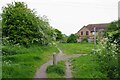
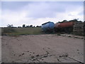
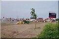
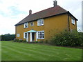
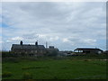
11 photos from this area
Area Information
Key information about the CO14 8TD including its size, population, and administrative classification.
- Area Type
- Postcode
- Area Size
- 4777 m²
- Population
- 1309
- Population Density
- 2442 people/km²
House Prices in CO14 8TD
12
Properties
£229,125
Average Sold Price
£50,000
Lowest Price
£365,000
Highest Price
Showing 12 properties
| Address | Type | Beds | Baths | Last Sale Price | Last Sale Date | |
|---|---|---|---|---|---|---|
| 190 Elm Tree Avenue, Walton On The Naze, CO14 8TD | Detached | 4 | 2 | £365,000 | Sep 2021 | |
| 198 Elm Tree Avenue, Walton On The Naze, CO14 8TD | Bungalow | 4 | 1 | £345,000 | Jul 2021 | |
| 192 Elm Tree Avenue, Walton On The Naze, CO14 8TD | Detached | 4 | 2 | £277,000 | Dec 2020 | |
| 196 Elm Tree Avenue, Walton On The Naze, CO14 8TD | Bungalow | 3 | 1 | £293,000 | Jun 2017 | |
| 194 Elm Tree Avenue, Walton On The Naze, CO14 8TD | Semi-detached | 3 | - | £225,000 | Mar 2014 | |
| 180 Elm Tree Avenue, Walton On The Naze, CO14 8TD | Terraced | 2 | - | £140,000 | Feb 2014 | |
| 184 Elm Tree Avenue, Walton On The Naze, CO14 8TD | house | 2 | - | £138,000 | Apr 2012 | |
| 178 Elm Tree Avenue, Walton On The Naze, CO14 8TD | Semi-detached | 2 | 1 | £50,000 | May 1999 | |
| Meadow Cottage, 186 Elm Tree Avenue, Walton On The Naze, CO14 8TD | house | 2 | 1 | - | - | |
| 176 Elm Tree Avenue, Walton On The Naze, CO14 8TD | Detached | 4 | 4 | - | - |
Page 1 of 2
Energy Efficiency in CO14 8TD
Amenities
Schools
| Rank | School | Type | Entry gender | Ages |
|---|
Explore more schools in this area
Go to Schools tabDemographics
Household Size
Two person
most common
Accommodation Type
Houses
most common
Tenure
79
majority
Ethnic Group
White
most common
Religion
N/A
most common
Household Composition
N/A
most common
Age
47
median
Elderly (65+ years)
most common
Household Deprivation
N/A
with no deprivation
NS-SEC
29
in Lower managerial occupations
Explore more demographic insights in this area
Go to Demographics tabPlanning
Planning Constraints
- Flood RiskPremium
- Ramsar Wetland SitesPremium
- Area of Outstanding Natural BeautyPremium
- Protected Nature ReservePremium
- Protected WoodlandPremium