Area Overview for CO14 8LF
Photos of CO14 8LF
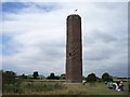
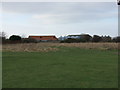
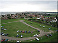
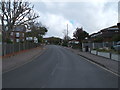
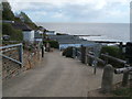
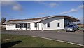
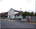
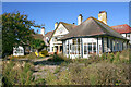
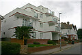
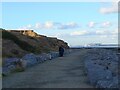
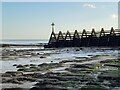
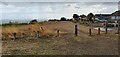
104 photos from this area
Area Information
Key information about the CO14 8LF including its size, population, and administrative classification.
- Area Type
- Postcode
- Area Size
- 17.8 hectares
- Population
- 1569
- Population Density
- 380 people/km²
House Prices in CO14 8LF
16
Properties
£492,000
Average Sold Price
£185,000
Lowest Price
£750,000
Highest Price
Showing 16 properties
| Address | Type | Beds | Baths | Last Sale Price | Last Sale Date | |
|---|---|---|---|---|---|---|
| Highfields, Old Hall Lane, Walton On The Naze, CO14 8LF | house | - | - | £495,000 | Mar 2021 | |
| High Hill House, Old Hall Lane, Walton On The Naze, CO14 8LF | house | - | - | £649,995 | Nov 2020 | |
| The Beach, Old Hall Lane, Walton On The Naze, CO14 8LF | Detached | 4 | 2 | £560,000 | Jan 2020 | |
| Teesdale, Old Hall Lane, Walton On The Naze, CO14 8LF | Detached | 4 | 1 | £430,000 | Oct 2016 | |
| The Anchorage, Old Hall Lane, Walton On The Naze, CO14 8LF | house | 4 | - | £575,000 | Jul 2016 | |
| Haven House, Old Hall Lane, Walton On The Naze, CO14 8LF | Bungalow | 4 | - | £470,000 | Dec 2015 | |
| 67 Old Hall Lane, Walton On The Naze, CO14 8LF | Detached | 4 | - | £385,000 | Nov 2014 | |
| Walton Hall, Old Hall Lane, Walton On The Naze, CO14 8LF | Detached | 6 | 3 | £750,000 | Mar 2014 | |
| The Willows, Old Hall Lane, Walton On The Naze, CO14 8LF | Detached | 4 | - | £420,000 | May 2013 | |
| Naze Lodge, Old Hall Lane, Walton On The Naze, CO14 8LF | Mobile Home | 2 | - | £185,000 | Apr 1997 |
Page 1 of 2
Energy Efficiency in CO14 8LF
Amenities
Schools
| Rank | School | Type | Entry gender | Ages |
|---|
Explore more schools in this area
Go to Schools tabDemographics
Household Size
Two person
most common
Accommodation Type
Houses
most common
Tenure
75
majority
Ethnic Group
White
most common
Religion
N/A
most common
Household Composition
N/A
most common
Age
47
median
Adults (30-64 years)
most common
Household Deprivation
N/A
with no deprivation
NS-SEC
26
in Lower managerial occupations
Explore more demographic insights in this area
Go to Demographics tabPlanning
Planning Constraints
- Flood RiskPremium
- Ramsar Wetland SitesPremium
- Area of Outstanding Natural BeautyPremium
- Protected Nature ReservePremium
- Protected WoodlandPremium