Area Overview for CO14 8HX
Photos of CO14 8HX
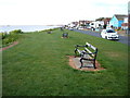
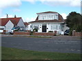
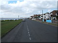
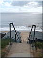
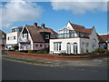
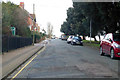
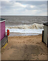
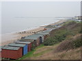
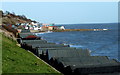
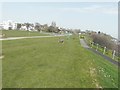
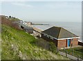
35 photos from this area
Area Information
Key information about the CO14 8HX including its size, population, and administrative classification.
- Area Type
- Postcode
- Area Size
- 1.2 hectares
- Population
- 1569
- Population Density
- 380 people/km²
House Prices in CO14 8HX
11
Properties
£460,000
Average Sold Price
£240,000
Lowest Price
£580,000
Highest Price
Showing 11 properties
| Address | Type | Beds | Baths | Last Sale Price | Last Sale Date | |
|---|---|---|---|---|---|---|
| Sunrise, Cliff Parade, Walton On The Naze, CO14 8HX | Detached | 3 | 3 | £560,000 | Nov 2024 | |
| East Lodge, Cliff Parade, Walton On The Naze, CO14 8HX | Detached | 4 | 2 | £580,000 | Apr 2021 | |
| Salthouse, Cliff Parade, Walton On The Naze, CO14 8HX | Detached | - | - | £240,000 | Sep 2002 | |
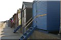
| Beach Hut 457, Front Row, Eastcliff Promenade, Walton On The Naze, CO14 8HX | Leisure | - | - | - | - | |
| Beach Hut 453, Front Row, Eastcliff Promenade, Walton On The Naze, CO14 8HX | Leisure | - | - | - | - | |
| Beach Hut 458, Front Row, Eastcliff Promenade, Walton On The Naze, CO14 8HX | Leisure | - | - | - | - | |
| Beach Hut 454, Front Row, Eastcliff Promenade, Walton On The Naze, CO14 8HX | Leisure | - | - | - | - | |
| Beach Hut 455, Front Row, Eastcliff Promenade, Walton On The Naze, CO14 8HX | Leisure | - | - | - | - | |
| Beach Hut 456, Front Row, Eastcliff Promenade, Walton On The Naze, CO14 8HX | Leisure | - | - | - | - | |
| Beach Hut 460, Front Row, Eastcliff Promenade, Walton On The Naze, CO14 8HX | Leisure | - | - | - | - |
Page 1 of 2
Energy Efficiency in CO14 8HX
Amenities
Schools
| Rank | School | Type | Entry gender | Ages |
|---|
Explore more schools in this area
Go to Schools tabDemographics
Household Size
Two person
most common
Accommodation Type
Houses
most common
Tenure
75
majority
Ethnic Group
White
most common
Religion
N/A
most common
Household Composition
N/A
most common
Age
47
median
Adults (30-64 years)
most common
Household Deprivation
N/A
with no deprivation
NS-SEC
26
in Lower managerial occupations
Explore more demographic insights in this area
Go to Demographics tabPlanning
Planning Constraints
- Flood RiskPremium
- Ramsar Wetland SitesPremium
- Area of Outstanding Natural BeautyPremium
- Protected Nature ReservePremium
- Protected WoodlandPremium