Area Overview for CO14 8HW
Photos of CO14 8HW
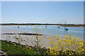


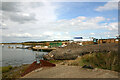
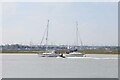
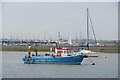
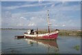
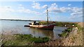
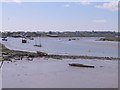
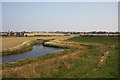
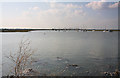
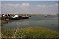
19 photos from this area
Area Information
Key information about the CO14 8HW including its size, population, and administrative classification.
- Area Type
- Postcode
- Area Size
- 27.8 hectares
- Population
- 1569
- Population Density
- 380 people/km²
House Prices in CO14 8HW
39
Properties
£138,286
Average Sold Price
£50,000
Lowest Price
£205,000
Highest Price
Showing 39 properties
| Address | Type | Beds | Baths | Last Sale Price | Last Sale Date | |
|---|---|---|---|---|---|---|
| 120A Hall Lane, Walton On The Naze, CO14 8HW | Flat | - | - | £84,000 | Jan 2021 | |
| 131 Hall Lane, Walton On The Naze, CO14 8HW | Semi-detached | 4 | 1 | £187,000 | May 2015 | |
| 101 Hall Lane, Walton On The Naze, CO14 8HW | Semi-detached | 4 | - | £205,000 | Jun 2010 | |
| 113 Hall Lane, Walton On The Naze, CO14 8HW | Semi-detached | 3 | 1 | £124,000 | Mar 2007 | |
| 107 Hall Lane, Walton On The Naze, CO14 8HW | Detached | - | - | £114,500 | Oct 2006 | |
| 103 Hall Lane, Walton On The Naze, CO14 8HW | Detached | - | - | £203,500 | Jan 2003 | |
| 115 Hall Lane, Walton On The Naze, CO14 8HW | Semi-detached | - | - | £50,000 | Jan 2001 | |
| 128 Hall Lane, Walton On The Naze, CO14 8HW | Terraced | 3 | 1 | - | - | |
| The Caravan Carousel Circus, Foundry Yard, Hall Lane, Walton On The Naze, CO14 8HW | Land | - | - | - | - | |
| Flat At, 123 Hall Lane, Walton On The Naze, CO14 8HW | Retail | 4 | 1 | - | - |
Page 1 of 4
Energy Efficiency in CO14 8HW
Amenities
Schools
| Rank | School | Type | Entry gender | Ages |
|---|
Explore more schools in this area
Go to Schools tabDemographics
Household Size
Two person
most common
Accommodation Type
Houses
most common
Tenure
75
majority
Ethnic Group
White
most common
Religion
N/A
most common
Household Composition
N/A
most common
Age
47
median
Adults (30-64 years)
most common
Household Deprivation
N/A
with no deprivation
NS-SEC
26
in Lower managerial occupations
Explore more demographic insights in this area
Go to Demographics tabPlanning
Planning Constraints
- Flood RiskPremium
- Ramsar Wetland SitesPremium
- Area of Outstanding Natural BeautyPremium
- Protected Nature ReservePremium
- Protected WoodlandPremium