Area Overview for CO13 9LH
Photos of CO13 9LH


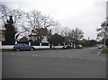
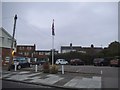
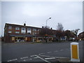
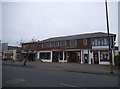
56 photos from this area
Area Information
Key information about the CO13 9LH including its size, population, and administrative classification.
- Area Type
- Postcode
- Area Size
- 6653 m²
- Population
- Not available
- Population Density
- Not available
House Prices in CO13 9LH
13
Properties
£328,286
Average Sold Price
£51,000
Lowest Price
£622,000
Highest Price
Showing 13 properties
| Address | Type | Beds | Baths | Last Sale Price | Last Sale Date | |
|---|---|---|---|---|---|---|
| 40 Upper Third Avenue, Frinton On Sea, CO13 9LH | Semi-detached | 2 | 1 | £365,000 | Jul 2024 | |
| 32 Upper Third Avenue, Frinton On Sea, CO13 9LH | house | - | - | £622,000 | Jul 2022 | |
| 31 Upper Third Avenue, Frinton On Sea, CO13 9LH | Bungalow | 2 | 1 | £420,000 | Mar 2022 | |
| 33 Upper Third Avenue, Frinton On Sea, CO13 9LH | Bungalow | - | - | £280,000 | Mar 2021 | |
| Marconia, 34 Upper Third Avenue, Frinton On Sea, CO13 9LH | Detached | 5 | - | £362,500 | Jun 2014 | |
| 35 Upper Third Avenue, Frinton On Sea, CO13 9LH | Semi-detached | - | - | £197,500 | Dec 2006 | |
| 36 Upper Third Avenue, Frinton On Sea, CO13 9LH | Detached | - | - | £51,000 | Feb 1996 | |
| 39 Upper Third Avenue, Frinton On Sea, CO13 9LH | Land | 1 | 2 | - | - | |
| 37 Upper Third Avenue, Frinton On Sea, CO13 9LH | Detached | - | - | - | - | |
| 38 Upper Third Avenue, Frinton On Sea, CO13 9LH | Semi-detached | - | - | - | - |
Page 1 of 2
Energy Efficiency in CO13 9LH
Amenities
Schools
| Rank | School | Type | Entry gender | Ages |
|---|
Explore more schools in this area
Go to Schools tabDemographics
Household Size
Two person
most common
Accommodation Type
Houses
most common
Tenure
84
majority
Ethnic Group
White
most common
Religion
N/A
most common
Household Composition
N/A
most common
Age
47
median
Elderly (65+ years)
most common
Household Deprivation
N/A
with no deprivation
NS-SEC
37
in Lower managerial occupations
Explore more demographic insights in this area
Go to Demographics tabPlanning
Planning Constraints
- Flood RiskPremium
- Ramsar Wetland SitesPremium
- Area of Outstanding Natural BeautyPremium
- Protected Nature ReservePremium
- Protected WoodlandPremium