Area Overview for CO12 5DE
Photos of CO12 5DE

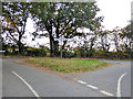
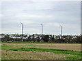

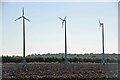
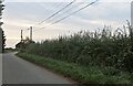
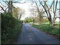

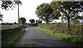

11 photos from this area
Area Information
Key information about the CO12 5DE including its size, population, and administrative classification.
- Area Type
- Postcode
- Area Size
- 46.2 hectares
- Population
- 1052
- Population Density
- 78 people/km²
House Prices in CO12 5DE
10
Properties
£460,000
Average Sold Price
£315,000
Lowest Price
£750,000
Highest Price
Showing 10 properties
| Address | Type | Beds | Baths | Last Sale Price | Last Sale Date | |
|---|---|---|---|---|---|---|
| Sisters Cottage, Colchester Road, Great Oakley, CO12 5DE | Detached | 4 | 2 | £750,000 | Jul 2024 | |
| Memory, Colchester Road, Great Oakley, CO12 5DE | Detached | 4 | 2 | £315,000 | Feb 2021 | |
| Brook Cottage, Colchester Road, Great Oakley, CO12 5DE | house | 3 | 1 | £350,000 | Nov 2016 | |
| Yperlee, Colchester Road, Stones Green, Harwich, CO12 5DE | Detached | 4 | - | £460,000 | Nov 2013 | |
| Cherry Dell, Colchester Road, Great Oakley, CO12 5DE | Detached | 3 | - | £425,000 | Mar 2012 | |
| Sewage Pumping Station No 3, Colchester Road, Great Oakley, CO12 5DE | Industrial | - | - | - | - | |
| Wind Turbine Land Adjacent Yperlee, Colchester Road, Great Oakley, CO12 5DE | Industrial | - | - | - | - | |
| Caravan At The Barn, Colchester Road, Great Oakley, CO12 5DE | Mobile Home | - | - | - | - | |
| The Cot, Colchester Road, Great Oakley, CO12 5DE | Detached | - | - | - | - | |
| Maltings Farm, Colchester Road, Great Oakley, CO12 5DE | Bungalow | - | - | - | - |
Energy Efficiency in CO12 5DE
Amenities
Schools
| Rank | School | Type | Entry gender | Ages |
|---|
Explore more schools in this area
Go to Schools tabDemographics
Household Size
Two person
most common
Accommodation Type
Houses
most common
Tenure
88
majority
Ethnic Group
White
most common
Religion
N/A
most common
Household Composition
N/A
most common
Age
47
median
Adults (30-64 years)
most common
Household Deprivation
N/A
with no deprivation
NS-SEC
36
in Lower managerial occupations
Explore more demographic insights in this area
Go to Demographics tabPlanning
Planning Constraints
- Flood RiskPremium
- Ramsar Wetland SitesPremium
- Area of Outstanding Natural BeautyPremium
- Protected Nature ReservePremium
- Protected WoodlandPremium