Area Overview for CO12 4SU
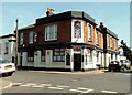
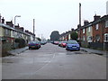
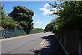
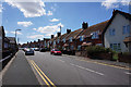
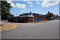
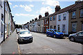
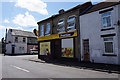
Photos of CO12 4SU


Area Information
Living in CO12 4SU means being part of a small, tightly knit residential cluster in the Tendring district of Essex. The postcode covers the villages of Ramsey and Parkeston, situated near Harwich, where the A120 crosses Ramsey Creek. With a population of 2,553 and a density of 1,015 people per square kilometre, this area blends rural charm with proximity to the River Stour and Parkeston Quay. Historically significant, the parish dates back to the Domesday Book and was once a key port for naval and commercial activity. Today, it retains a quiet village character, with the River Stour and nearby Harwich offering a mix of coastal and inland appeal. Residents benefit from nearby ferry services, rail links, and a modest selection of local amenities. The area’s compact size ensures a sense of community, though its small footprint means limited expansion. For those seeking a peaceful, historic setting with easy access to transport and natural features, CO12 4SU offers a distinctive blend of heritage and practicality.
- Area Type
- Postcode
- Area Size
- Not available
- Population
- 2553
- Population Density
- 1015 people/km²
The property market in CO12 4SU is characterised by a high rate of home ownership—59% of residents own their homes. This suggests a community of long-term residents rather than a transient rental market. The predominant accommodation type is houses, which aligns with the area’s rural village setting and limited density. Given the small size of the postcode, the housing stock is likely to be modest in scale, with properties concentrated in the villages of Ramsey and Parkeston. Buyers should expect a focus on single-family homes rather than apartments or high-density developments. The compact nature of the area means that property choices may be limited, though the proximity to Harwich and nearby transport links could enhance the appeal of homes in CO12 4SU. For those seeking a traditional, owner-occupied home in a historic setting, this area offers a distinct opportunity, though the small footprint may restrict availability.
House Prices in CO12 4SU
No properties found in this postcode.
Energy Efficiency in CO12 4SU
Life in CO12 4SU is shaped by its proximity to local amenities and natural features. The area has five retail outlets, including Lidl Upper, Morrisons Upper, and the East of England Co-operative Co, offering everyday shopping needs. Rail stations such as Harwich International Railway Station provide access to regional transport networks, while ferry services at Shotley Point Marina and Harwich Harbour connect residents to coastal and inland destinations. The village setting is complemented by the River Stour and the historical Parkeston Quay, which adds a sense of heritage and scenic appeal. The compact nature of the area means that amenities are within practical reach, though the small size of the postcode limits the variety of leisure options. Residents can enjoy a mix of rural tranquillity and access to transport, making it suitable for those who value convenience without sacrificing a peaceful environment.
Amenities
Schools
The nearest school to CO12 4SU is Chase Lane Primary School and Nursery, which provides education for younger children and holds a good Ofsted rating. This primary school is a key local institution, offering a reliable option for families with young children. The absence of secondary schools in the immediate area means that students may need to commute to nearby towns for further education. However, the good rating at Chase Lane suggests a solid foundation for early learning. For families prioritising strong primary education, this school is a notable asset. The limited number of schools in the area reflects the small size of CO12 4SU, but the quality of the existing institution indicates that educational needs are met at the primary level. Parents should consider the need for secondary schooling when evaluating the long-term suitability of the area for their family.
| Rank | School | Type | Entry gender | Ages |
|---|
Explore more schools in this area
Go to Schools tabDemographics
The community in CO12 4SU is predominantly middle-aged, with a median age of 47 and the most common age range being adults aged 30–64. This suggests a stable population with a strong presence of working-age individuals and families. Home ownership is relatively high at 59%, indicating a community of long-term residents rather than transient renters. The accommodation type is primarily houses, reflecting a preference for detached or semi-detached properties over flats. The predominant ethnic group is White, though no specific data on diversity or minority representation is provided. The population density of 1,015 people per square kilometre implies a compact, closely knit community. While no deprivation data is available, the mix of home ownership and age demographics suggests a balance between established residents and potential for new families. The absence of specific diversity metrics means the full range of community experiences cannot be fully described, but the data highlights a stable, family-oriented demographic profile.
Household Size
Accommodation Type
Tenure
Ethnic Group
Religion
Household Composition
Age
Household Deprivation
NS-SEC
Explore more demographic insights in this area
Go to Demographics tabPlanning
Planning Constraints
- Flood RiskPremium
- Ramsar Wetland SitesPremium
- Area of Outstanding Natural BeautyPremium
- Protected Nature ReservePremium
- Protected WoodlandPremium