Area Overview for CO12 4EX
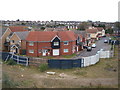
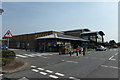
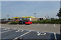
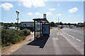
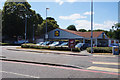
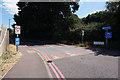
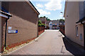
Photos of CO12 4EX

Area Information
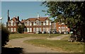
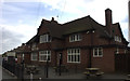
CO12 4EX is a compact residential postcode in Essex, nestled within the historic port town of Harwich. Covering 6,936 square metres, this area is densely populated, with 1,796 residents living at a density of 258,943 people per square kilometre. Harwich, the broader area, has long been a maritime hub, its economy shaped by its position on the River Stour’s estuary. The town’s history is steeped in port activity, from medieval markets to its role in William of Orange’s 1688 landing. Today, CO12 4EX reflects this legacy, with a tight-knit community centred around family homes and local amenities. The area’s proximity to Dovercourt and the North Sea coast offers a blend of coastal charm and practical connectivity. With rail stations, ferries, and retail outlets nearby, residents enjoy access to both urban conveniences and the tranquillity of a seaside town. The population’s median age of 47 suggests a mature, established community, many of whom live in owner-occupied homes. Living here means navigating a mix of historical heritage and modern infrastructure, with the town’s Grade I-listed Guildhall and medieval sailmaker’s house standing as reminders of Harwich’s maritime past.
- Area Type
- Postcode
- Area Size
- 6936 m²
- Population
- 1796
- Population Density
- 4112 people/km²
The property market in CO12 4EX is characterised by a 53% home ownership rate, with houses making up the majority of accommodation types. This suggests a mix of owner-occupied homes and rental properties, though the lower home ownership rate compared to national averages indicates a reliance on private rentals. The small area size and high population density imply a compact housing stock, likely centred on family homes and semi-detached properties. Given the mature age profile of residents, the market may cater to downsizing or long-term occupancy rather than investment speculation. The proximity to Harwich’s port and transport links could enhance property value, though the limited size of the postcode means buyers should consider the broader Harwich and Dovercourt area for more options. For those seeking homes in CO12 4EX, the focus is on practical, established properties rather than luxury or new developments. The market’s character reflects the area’s historical role as a residential hub for working-age adults, with limited scope for high-end or speculative purchases.
House Prices in CO12 4EX
Showing 2 properties
| Address | Type | Beds | Baths | Last Sale Price | Last Sale Date | |
|---|---|---|---|---|---|---|
| Mayflower Medical Centre, Fryatt Hospital, 419 Main Road, Harwich, CO12 4EX | primary_healthcare | - | - | - | - | |
| Borno Chemists, Fryatt Hospital, 419 Main Road, Harwich, CO12 4EX | commercial | - | - | - | - |
Energy Efficiency in CO12 4EX
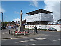
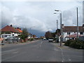
Life in CO12 4EX is shaped by its proximity to Harwich’s coastal amenities and practical retail options. The area’s retail scene includes five shops, such as the East of England Co-operative Co, Lidl, and Morrisons, providing everyday essentials within walking distance. Rail stations like Dovercourt and Harwich International offer easy access to London and other cities, while ferry services to Harwich Harbour and Shotley Point connect residents to the North Sea coast. The town’s maritime heritage is complemented by its modern infrastructure, with the port remaining a central economic driver. For leisure, the nearby St. Nicholas Church and Harwich Guildhall offer historical interest, though parks or green spaces are not explicitly mentioned. The mix of retail, transport, and coastal access ensures a convenient lifestyle, blending practicality with the charm of a seaside town.
Amenities
Schools
CO12 4EX is served by a range of schools, including All Saints’ Church of England Voluntary Aided Primary School in Dovercourt, which holds a ‘good’ Ofsted rating. The Harwich School and Harwich and Dovercourt High School provide primary and secondary education, with the latter rated ‘good’ by Ofsted. The mix of primary and academy schools offers families a choice of state-funded options, though no independent or private schools are listed. The presence of a ‘good’-rated high school suggests a focus on quality education, though the absence of data on school performance beyond Ofsted ratings limits deeper analysis. For families prioritising academic standards, the ‘good’ ratings indicate reliable education, though the lack of detailed performance metrics means outcomes may vary. The proximity of schools to residential areas ensures accessibility, supporting a community where education is a key consideration for homebuyers.
| Rank | School | Type | Entry gender | Ages |
|---|
Explore more schools in this area
Go to Schools tabDemographics
The population of CO12 4EX is 1,796, with a median age of 47, indicating a community skewed towards middle-aged adults. The most common age range is 30–64 years, suggesting a stable, working-age population. Home ownership is at 53%, with houses being the predominant accommodation type. This reflects a mix of owner-occupied properties and rental stock, though the lower home ownership rate compared to national averages implies some reliance on private rentals. The predominant ethnic group is White, aligning with broader trends in the area. The absence of specific deprivation data means the quality of life cannot be fully assessed, but the high population density and mature age profile suggest a well-established, perhaps insular community. With no mention of diversity metrics, the area appears homogenous in composition. The demographic profile indicates a place where families and long-term residents predominate, with fewer young professionals or students. This stability may influence local services and amenities, tailored to the needs of an older, settled population.
Household Size
Accommodation Type
Tenure
Ethnic Group
Religion
Household Composition
Age
Household Deprivation
NS-SEC
Explore more demographic insights in this area
Go to Demographics tabPlanning
Planning Constraints
- Flood RiskPremium
- Ramsar Wetland SitesPremium
- Area of Outstanding Natural BeautyPremium
- Protected Nature ReservePremium
- Protected WoodlandPremium